


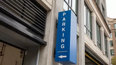
A new tool from TransForm shows where parking is underutilized in the Bay Area, even finding wasted space in a city as notorious for parking difficulties as San Francisco.
Rachel Dovey shares the details of Oakland-based non-profit TransForm, which launched a new database last week to help show that "parking structures in Northern California’s urban core are actually underutilized..." Dovey describes how the tool works:
The tool, called the GreenTrip Parking Database, overlays multifamily housing data on Google Maps, focusing primarily on high-growth areas like the East and South Bay. With over 65 complexes shown, users can filter information into sub-categories (to find only buildings with a certain number of units, say, or only buildings located in a certain city). Each tailored search brings up a page with parking information: the number of spaces allotted per unit, the number of spaces actually being used and then, most significantly, the cost of that unused space.
The article also includes information on how TransForm created the database.
FULL STORY: New Tool Maps Bay Area’s Expensive, Unused Parking


Austin Ends Parking Minimums
The city approved changes called for by a May resolution that eliminate parking requirements in all neighborhoods.
Parking Reform Pays Off With Lower Rent Costs
Research continues to show that adjusting parking requirements to align with demand can lower the cost of housing.

Norman, Oklahoma Eliminates Parking Mandates
The city made a subtle, one-word change that frees up developers to build parking based on actual need and eliminates costly unnecessary parking.

Trump Administration Could Effectively End Housing Voucher Program
Federal officials are eyeing major cuts to the Section 8 program that helps millions of low-income households pay rent.

Planetizen Federal Action Tracker
A weekly monitor of how Trump’s orders and actions are impacting planners and planning in America.

Ken Jennings Launches Transit Web Series
The Jeopardy champ wants you to ride public transit.

Washington Legislature Passes Rent Increase Cap
A bill that caps rent increases at 7 percent plus inflation is headed to the governor’s desk.

From Planning to Action: How LA County Is Rethinking Climate Resilience
Chief Sustainability Officer Rita Kampalath outlines the County’s shift from planning to implementation in its climate resilience efforts, emphasizing cross-departmental coordination, updated recovery strategies, and the need for flexible funding.

New Mexico Aging Department Commits to Helping Seniors Age ‘In Place’ and ‘Autonomously’ in New Draft Plan
As New Mexico’s population of seniors continues to grow, the state’s aging department is proposing expanded initiatives to help seniors maintain their autonomy while also supporting family caregivers.
Urban Design for Planners 1: Software Tools
This six-course series explores essential urban design concepts using open source software and equips planners with the tools they need to participate fully in the urban design process.
Planning for Universal Design
Learn the tools for implementing Universal Design in planning regulations.
Heyer Gruel & Associates PA
Ada County Highway District
Institute for Housing and Urban Development Studies (IHS)
City of Grandview
Harvard GSD Executive Education
Toledo-Lucas County Plan Commissions
Salt Lake City
NYU Wagner Graduate School of Public Service