


Daniel Kay Hertz shares a map tracking the population of neighborhoods in Chicago since 1950, providing insights into how the city has changed.
Hertz begins the post by explaining why population is so important (e.g., implications on tax receipts, job access, etc.) before sharing a map that shows surprising trends and steep population losses in many parts of the cities.
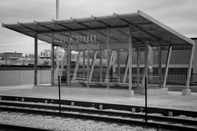
From Hertz's observations of the map:
- "The historic 'black belt' – the area from roughly 26th down to Woodlawn (the neighborhood), from the Dan Ryan to the lake – got hammered. This isn’t surprising for a number of reasons. The first is that the black belt – especially the older parts in central Bronzeville – was horrifically overcrowded in the 1940s."
- "The wealthy north lakefront neighborhoods have lost significant population, contrary to popular belief."
There is more detail and insight (plus: the map) available in the post, but Hertz also promises to write more on the theme in the future.
FULL STORY: Where Did Chicago's PopulatioN Decline?


Editorial Sounds Alarms About the 'Illinois Exodus'
The Chicago Tribune sends a message to the political leadership of Illinois and Chicago about population decline, and its causes.

Understanding Cities Through Their Life Cycles
Cities go through ups and downs over time, and where a city is in its longer history can reveal the reasons behind population changes.

Op-Ed: Good Design Isn't Just for Downtowns
Richard Driehaus attests to the importance of intentional, context-oriented design on the neighborhood level.

Alabama: Trump Terminates Settlements for Black Communities Harmed By Raw Sewage
Trump deemed the landmark civil rights agreement “illegal DEI and environmental justice policy.”

Planetizen Federal Action Tracker
A weekly monitor of how Trump’s orders and actions are impacting planners and planning in America.

The 120 Year Old Tiny Home Villages That Sheltered San Francisco’s Earthquake Refugees
More than a century ago, San Francisco mobilized to house thousands of residents displaced by the 1906 earthquake. Could their strategy offer a model for the present?

In Both Crashes and Crime, Public Transportation is Far Safer than Driving
Contrary to popular assumptions, public transportation has far lower crash and crime rates than automobile travel. For safer communities, improve and encourage transit travel.

Report: Zoning Reforms Should Complement Nashville’s Ambitious Transit Plan
Without reform, restrictive zoning codes will limit the impact of the city’s planned transit expansion and could exclude some of the residents who depend on transit the most.

Judge Orders Release of Frozen IRA, IIJA Funding
The decision is a victory for environmental groups who charged that freezing funds for critical infrastructure and disaster response programs caused “real and irreparable harm” to communities.
Urban Design for Planners 1: Software Tools
This six-course series explores essential urban design concepts using open source software and equips planners with the tools they need to participate fully in the urban design process.
Planning for Universal Design
Learn the tools for implementing Universal Design in planning regulations.
Clanton & Associates, Inc.
Jessamine County Fiscal Court
Institute for Housing and Urban Development Studies (IHS)
City of Grandview
Harvard GSD Executive Education
Toledo-Lucas County Plan Commissions
Salt Lake City
NYU Wagner Graduate School of Public Service