


By assessing three different groups of indicators, researchers were able to tour thousands of blocks in Chicago through Google Street View and compare visual signs of reinvestment and renewal between 2007 and 2009.
As reported by Alissa Walker at Gizmodo, a new study by Jackelyn Hwang and Robert J. Sampson published in the American Sociology Review followed the movement of middle and upper-middle-class residents within Chicago's various neighborhoods. However, instead of looking at migratory patterns via Census records, Hwang and Sampson were able to, "isolate three different groups of indicators found on Google Street View images—structural mix, beautification, and lack of disorder and decay—to rank each block" for reinvestment and renewal.
Besides ranking assessed from indicators based on the properties, the study also factors in other forms of investment or disinvestment. For example, "speed bumps and bike lanes are proof of public investment and therefore boosted the block's rating. The presence of trash and graffiti... resulted in a lower score."
Some of the results found when cross-referencing the study's predictors with actual city data help to quantify the spread of gentrification. As Walker notes,
"while [Hwang and Sampson] could clearly see which blocks had showed early signs of gentrification, the process was only likely to continue if at least 35 percent of the residents were white. Even if some gentrification signs were present in neighborhoods that were 40 percent or more black, the process slowed down or eventually stopped."
FULL STORY: Even Scientists Are Using Google Street View to Measure Gentrification


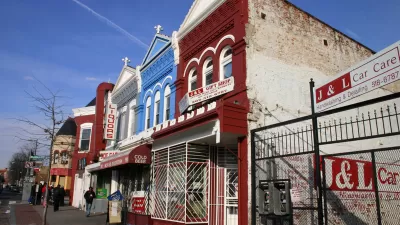
Houston's East River Redevelopment Threatens Historic Black Neighborhoods
Longtime residents are being left behind by new development that has raised housing costs and property taxes for some of Houston's most vulnerable communities, according to an article in the Houston Chronicle.
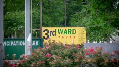
A Tour of Houston's Rapidly Gentrifying Neighborhoods
These Houston communities have experienced the most dramatic demographic changes in the last decade, according to new Census data.
Is Anti-Growth the Wrong Approach to Fighting Gentrification?
Limiting development has been a powerful tool for anti-gentrification activists, but have these policies had counter-productive effects?

Alabama: Trump Terminates Settlements for Black Communities Harmed By Raw Sewage
Trump deemed the landmark civil rights agreement “illegal DEI and environmental justice policy.”

Planetizen Federal Action Tracker
A weekly monitor of how Trump’s orders and actions are impacting planners and planning in America.

The 120 Year Old Tiny Home Villages That Sheltered San Francisco’s Earthquake Refugees
More than a century ago, San Francisco mobilized to house thousands of residents displaced by the 1906 earthquake. Could their strategy offer a model for the present?

In Both Crashes and Crime, Public Transportation is Far Safer than Driving
Contrary to popular assumptions, public transportation has far lower crash and crime rates than automobile travel. For safer communities, improve and encourage transit travel.

Report: Zoning Reforms Should Complement Nashville’s Ambitious Transit Plan
Without reform, restrictive zoning codes will limit the impact of the city’s planned transit expansion and could exclude some of the residents who depend on transit the most.

Judge Orders Release of Frozen IRA, IIJA Funding
The decision is a victory for environmental groups who charged that freezing funds for critical infrastructure and disaster response programs caused “real and irreparable harm” to communities.
Urban Design for Planners 1: Software Tools
This six-course series explores essential urban design concepts using open source software and equips planners with the tools they need to participate fully in the urban design process.
Planning for Universal Design
Learn the tools for implementing Universal Design in planning regulations.
Clanton & Associates, Inc.
Jessamine County Fiscal Court
Institute for Housing and Urban Development Studies (IHS)
City of Grandview
Harvard GSD Executive Education
Toledo-Lucas County Plan Commissions
Salt Lake City
NYU Wagner Graduate School of Public Service