


Wesley E. Highfield, Walter Gillis Peacock, and Shannon Van Zandt from Texas A&M examine the damage after Hurricane Ike and its relationship to social vulnerability (Available via Open Access, http://goo.gl/K) in a new JPER article.

Three researchers from Texas A&M University (Wesley E. Highfield, Walter Gillis Peacock, and Shannon Van Zandt) recently examined the damage after Hurricane Ike and its relationship to social vulnerability. This new research in Journal of Planning Education and Research (Available via Open Access, http://goo.gl/KteyFv) explores an important facet of resilience, which is not traditionally incorporated into hazard assessments. Ike caused billions of dollars of physical damage, loss of life, and has left a legacy of physical destruction on the Texas Gulf Coast (See, http://goo.gl/Tr6X8O).

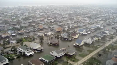
Figure 1 USGS http://goo.gl/vaAGra (Image USGS & Dr. Asbury Sallenger)
The authors’ focus on social vulnerability is particularly relevant given the current and projected impacts of climate change in the U.S. as outlined in the National Climate Assessment (See, http://goo.gl/YU3OkC). The NCA follows global attention to the issue of climate related disasters. Such interest has been triggered by unprecedented heat waves in Europe, flooding in Latin America, and desertification in Africa.
Climate related natural disasters are of particular concern in coastal areas, which raises the question of who will bear the majority of the risk in these at-risk areas. The Texas A&M researchers suggest that socially vulnerable populations also live in more precarious areas and face higher disaster related costs. However, despite the significance of social vulnerability in mediating hazard risk, most disaster mitigation has only focused on the physical elements of structures (e.g., structural elements and seismic risk) and their hazard exposure (e.g., location in a FEMA delimited high risk flood zone).
Aspects of social vulnerability include, “… poverty, race/ethnicity, age, gender, household composition, and housing tenure, [which together] capture the variability in household capacity for both mitigation and recovery.” (Highfield et al 2014, 1). These factors can influence both ability to recover from a disaster, and susceptibility to initial damage.

Figure 2 Ike’s Path (Highfield et al 2014)
To test the role of social vulnerability in predicting damage exposure, the authors compared damage levels in communities on Galveston Island and Bolivar Peninsula (See Figure 2, above), which are next to each other, but have different socioeconomic realities. The storm caused a 17.5-foot storm surge on Bolivar Island and nearly 14-foot surges on Galveston Island. The researchers and students from Texas A&M coastal management classes collected data about damage levels gathered by analyzing the amount of damage to 1,500 randomly selected houses in greater Galveston (See Figure 3, below).
Using information from their damage assessments, Highfield, Peackock, and Van Zant created a regression model that took into consideration (p. 10, Table 3) all three risk factors: structural, locational hazard, and social. They measured social vulnerability as: 1) the proportion of Black and Hispanic population at the block level; and 2) the improved value of the house (See, p. 7). In other words, they represented social vulnerability as membership in a disadvantaged group or lower home values, a proxy of home value and socio economic status.

Figure 3 Highfield et al (2014), dots indicate structures included in the study.
The article concludes that:
“…hazard exposure and structural vulnerability factors were important determinants of damage. However, even after controlling for these factors, areas with high proportions of nonwhite residents and lower-valued homes received more damage than their higher-valued counterparts in predominantly white areas despite being farther from or outside high-risk areas.” (Highfield et al 2014, p. 3)
Highfield and his collaborators also found that building damage significantly decreased for homes built after 1961, a trend that has continued increasingly into the present. Galveston implemented stricter building codes in the late 1950s, and these better practices seem to be increasing in the building industry. However, the larger take away from this article is that race and income matter in disaster vulnerability, and should be an integral part of mitigation planning.
For all of the details from this article, enjoy Free Access until June 30, 2014, via SAGE Publication’s online portal: http://goo.gl/KteyFv.
Highfield, Wesley E., Walter Gillis Peacock, and Shannon Van Zandt. "Mitigation Planning Why Hazard Exposure, Structural Vulnerability, and Social Vulnerability Matter."Journal of Planning Education and Research(2014): 0739456X14531828.
If you like this article, please follow @JPER7 on twitter or join our Facebook group : https://www.facebook.com/JPERPlanning.
Other Recent Disaster Related Articles in JPER:
Berke, Philip R., Ward Lyles, and Gavin Smith. "Impacts of Federal and State Hazard Mitigation Policies on Local Land Use Policy."Journal of Planning Education and Research (2014): 0739456X13517004.
Osland, Anna C. "Using Land-Use Planning Tools to Mitigate Hazards Hazardous Liquid and Natural Gas Transmission Pipelines."Journal of Planning Education and Research 33, no. 2 (2013): 141-159.
Mueller, Elizabeth J., Holly Bell, Beth Brunsma Chang, and John Henneberger. "Looking for Home after Katrina Postdisaster Housing Policy and Low-Income Survivors."Journal of Planning Education and Research 31, no. 3 (2011): 291-307.
Guthrie, Andrew and Fan, Yingling. “Streetcars and Recovery: An Analysis of Post-Katrina Building Permits around New Orleans Streetcar Lines.” Journal of Planning Education and Research 33, no. 4 (2013): 381-394.
Berke, Philip R., Yan Song, and Mark Stevens. "Integrating hazard mitigation into New Urban and conventional developments."Journal of Planning Education and Research 28, no. 4 (2009): 441-455.


Alabama: Trump Terminates Settlements for Black Communities Harmed By Raw Sewage
Trump deemed the landmark civil rights agreement “illegal DEI and environmental justice policy.”

Planetizen Federal Action Tracker
A weekly monitor of how Trump’s orders and actions are impacting planners and planning in America.

The 120 Year Old Tiny Home Villages That Sheltered San Francisco’s Earthquake Refugees
More than a century ago, San Francisco mobilized to house thousands of residents displaced by the 1906 earthquake. Could their strategy offer a model for the present?

Ken Jennings Launches Transit Web Series
The Jeopardy champ wants you to ride public transit.

BLM To Rescind Public Lands Rule
The change will downgrade conservation, once again putting federal land at risk for mining and other extractive uses.

Indy Neighborhood Group Builds Temporary Multi-Use Path
Community members, aided in part by funding from the city, repurposed a vehicle lane to create a protected bike and pedestrian path for the summer season.
Urban Design for Planners 1: Software Tools
This six-course series explores essential urban design concepts using open source software and equips planners with the tools they need to participate fully in the urban design process.
Planning for Universal Design
Learn the tools for implementing Universal Design in planning regulations.
Clanton & Associates, Inc.
Jessamine County Fiscal Court
Institute for Housing and Urban Development Studies (IHS)
City of Grandview
Harvard GSD Executive Education
Toledo-Lucas County Plan Commissions
Salt Lake City
NYU Wagner Graduate School of Public Service