


Eric Jaffe reports on a simulation method used by the Regional Plan Association to bridge gaps in community engagement while developing the Fourth Regional Plan.
"RPA has created 10 profiles meant to represent — in a statistically true sense — the people who live in the region. The personas will serve as a sort of fictional oversight panel tasked with holding the [Regional Plan Association's Fourth Regional Plan] accountable to its true mission," reports Eric Jaffe.
Jaffe explains just how the RPA generated the "avatars": "RPA derived the profiles (or avatars, as they're called in-house) from the latest Census data. Geography was the overarching metric, followed by 13 separate statistics chosen to align the profiles with actual metro area demographics as closely as possible. Since only 8 percent of the region lives in Manhattan, for instance, only one avatar calls it home; and since Manhattan also has one of the area's largest white populations, that avatar also is white. And on down the list."
"Once the plan is more fleshed out, the avatars could function as a kind of jury to evaluate the strength of a particular plan element."
FULL STORY: Meet the 10 People Who Will Plan New York's Future


The Fourth Regional Plan Plots a Course for the New York Region
The Regional Plan Association released its eagerly anticipated Fourth Regional Plan on Thursday.
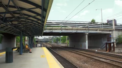
Study: New York Suburbs Need to Zone for Higher Density Transit Oriented Development
The Regional Plan Association released a new study that recommends steps toward higher density transit oriented development in transit adjacent communities around the New York region. The study also teases a big release coming later this month.
Design Competition Yields a New Look for the Proposed Triboro Transit Line
The design proposal for the Triboro Corridor is speculative, but meant to inspire the conversation on one of the "4c" ideas at the heart of the Regional Plan Association's Fourth Regional Plan.

Trump Administration Could Effectively End Housing Voucher Program
Federal officials are eyeing major cuts to the Section 8 program that helps millions of low-income households pay rent.

Planetizen Federal Action Tracker
A weekly monitor of how Trump’s orders and actions are impacting planners and planning in America.

Ken Jennings Launches Transit Web Series
The Jeopardy champ wants you to ride public transit.

Rebuilding Smarter: How LA County Is Guiding Fire-Ravaged Communities Toward Resilience
Los Angeles County is leading a coordinated effort to help fire-impacted communities rebuild with resilience by providing recovery resources, promoting fire-wise design, and aligning reconstruction with broader sustainability and climate goals.

When Borders Blur: Regional Collaboration in Action
As regional challenges outgrow city boundaries, “When Borders Blur” explores how cross-jurisdictional collaboration can drive smarter, more resilient urban planning, sharing real-world lessons from thriving partnerships across North America.

Philadelphia Is Expanding its Network of Roundabouts
Roundabouts are widely shown to decrease traffic speed, reduce congestion, and improve efficiency.
Urban Design for Planners 1: Software Tools
This six-course series explores essential urban design concepts using open source software and equips planners with the tools they need to participate fully in the urban design process.
Planning for Universal Design
Learn the tools for implementing Universal Design in planning regulations.
Ada County Highway District
Clanton & Associates, Inc.
Jessamine County Fiscal Court
Institute for Housing and Urban Development Studies (IHS)
City of Grandview
Harvard GSD Executive Education
Toledo-Lucas County Plan Commissions
Salt Lake City
NYU Wagner Graduate School of Public Service