


If you're looking for more data on housing in the United States, a dataset produced by the United States Postal Service has many advantages.
Kriston Capps reports on a surprising but valuable source of data on housing: the United States Postal Service (USPS). "The Address Management System is a dataset compiled by USPS mail carriers and updated on the go as they perform their duties. Rain or shine, more than 307,000 mail carriers deliver mail to U.S. addresses nearly every day of the week. Mail carriers also compile parcel-level vacancy data to increase postal efficiencies, specifically by noting vacancies. These data help USPS clean up address lists that the agency provides to bulk mailers, among other things."
Since 2004, the U.S. Department of Housing and Urban Development has received USPS's national address data (while preserving privacy of address-holders). Every quarter, however, "USPS hands [the data] over to HUD—in the form of ZIP+4 Code-level data aggregated to the 2010 U.S. Census Tract level."
"Once the data are geocoded to the Census Tract level (a proxy for neighborhoods), HUD shares the data with non-profit and research organizations who apply for access."
Capps cites the expertise of Sarah Duda, associate director Institute for Housing Studies at DePaul University, in explaining the value of the data. "There's no better dataset for tracking blight in Chicago, Duda says. Chicago's data for building violations, for example, are skewed by the fact that multifamily buildings require more permits and inspections than single-family units. And 40 percent of calls to 311 in Chicago are duplicate requests."
FULL STORY: USPS Mail Carriers Are Also Collecting Crucial Housing Data

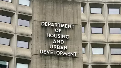
HUD Proposes Updates to HOME Grant Program
The agency’s proposal would streamline and modernize its largest affordable housing grant program, which will award $1.3 billion in FY 2024.
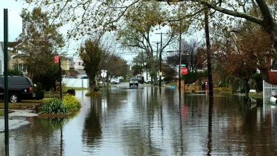
HUD Issues New Flood Protection Rules
Housing that uses federal funding will be subject to stricter regulations that reflect increasing flood risks.

HUD Resiliency Awards Target Affordable Multifamily Housing
The Green and Resilient Retrofit program aims to reduce vulnerability to climate challenges and improve energy efficiency in multifamily buildings.

Alabama: Trump Terminates Settlements for Black Communities Harmed By Raw Sewage
Trump deemed the landmark civil rights agreement “illegal DEI and environmental justice policy.”

Planetizen Federal Action Tracker
A weekly monitor of how Trump’s orders and actions are impacting planners and planning in America.

The 120 Year Old Tiny Home Villages That Sheltered San Francisco’s Earthquake Refugees
More than a century ago, San Francisco mobilized to house thousands of residents displaced by the 1906 earthquake. Could their strategy offer a model for the present?

Ken Jennings Launches Transit Web Series
The Jeopardy champ wants you to ride public transit.

BLM To Rescind Public Lands Rule
The change will downgrade conservation, once again putting federal land at risk for mining and other extractive uses.

Indy Neighborhood Group Builds Temporary Multi-Use Path
Community members, aided in part by funding from the city, repurposed a vehicle lane to create a protected bike and pedestrian path for the summer season.
Urban Design for Planners 1: Software Tools
This six-course series explores essential urban design concepts using open source software and equips planners with the tools they need to participate fully in the urban design process.
Planning for Universal Design
Learn the tools for implementing Universal Design in planning regulations.
Clanton & Associates, Inc.
Jessamine County Fiscal Court
Institute for Housing and Urban Development Studies (IHS)
City of Grandview
Harvard GSD Executive Education
Toledo-Lucas County Plan Commissions
Salt Lake City
NYU Wagner Graduate School of Public Service