


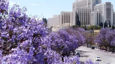
"What does a city look like drawn in trees?" Cambridge, Massachusetts recently released an exhaustive database of all the trees on public property around the city.
The Boston Globe shares insights into the data contained in the Camridge Tree Map. For instance, "[the] most common are maple, honeylocust, and oak, with a healthy scattering of ornamental fruit and berry trees." The article includes a very colorful map, among other infographics, of the "density of blossoms" around the city.
"The map doesn’t include every tree in the city: It skips the many in private yards and on university property. But what remains is an intriguing snapshot of how a bird, a bee, or an ambitious grain of pollen might experience the city."
The database, released to the public in April, follows a seven-year effort by the Cambridge Department of Public Works.
FULL STORY: A tree map of Cambridge

LA County Releases Draft Community Forest Management Plan
LA County's Chief Sustainability Office just released the discussion draft of Room to Grow, the first Community Forest Management Plan for the county.
The Problem with Tree Planting Programs
Ambitious campaigns to plant trees in urban areas often don't take into account the complexities of growing and maintaining effective urban forests.
Hug a Tree. Protect a Forest.
Communities have good reasons to protect trees and forests. Planners can help make this happen.

Alabama: Trump Terminates Settlements for Black Communities Harmed By Raw Sewage
Trump deemed the landmark civil rights agreement “illegal DEI and environmental justice policy.”

Planetizen Federal Action Tracker
A weekly monitor of how Trump’s orders and actions are impacting planners and planning in America.

The 120 Year Old Tiny Home Villages That Sheltered San Francisco’s Earthquake Refugees
More than a century ago, San Francisco mobilized to house thousands of residents displaced by the 1906 earthquake. Could their strategy offer a model for the present?

Indy Neighborhood Group Builds Temporary Multi-Use Path
Community members, aided in part by funding from the city, repurposed a vehicle lane to create a protected bike and pedestrian path for the summer season.

Congestion Pricing Drops Holland Tunnel Delays by 65 Percent
New York City’s contentious tolling program has yielded improved traffic and roughly $100 million in revenue for the MTA.

In Both Crashes and Crime, Public Transportation is Far Safer than Driving
Contrary to popular assumptions, public transportation has far lower crash and crime rates than automobile travel. For safer communities, improve and encourage transit travel.
Urban Design for Planners 1: Software Tools
This six-course series explores essential urban design concepts using open source software and equips planners with the tools they need to participate fully in the urban design process.
Planning for Universal Design
Learn the tools for implementing Universal Design in planning regulations.
Clanton & Associates, Inc.
Jessamine County Fiscal Court
Institute for Housing and Urban Development Studies (IHS)
City of Grandview
Harvard GSD Executive Education
Toledo-Lucas County Plan Commissions
Salt Lake City
NYU Wagner Graduate School of Public Service