


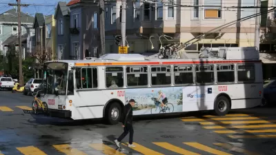
Proposals for light rail, streetcar, and BRT lines spread in every direction from Washington D.C. into nearby climes. Although some are more realistic than others, one blog dares to dream about what the full extent of the proposals would look like.
Dan Malouff writes a post, and creates a map, that imagines the full extent of the 267 miles of proposed light rail, streetcar, and bus rapid transit lines proposed in the D.C. metro area.
"This map combines the DC streetcar and MoveDC bus lane plan with the Arlington streetcar plan, the Alexandria transitway plan, Montgomery's BRT plan, and Fairfax's transit network plan, plus the Purple Line, the Corridor Cities Transitway, the Long Bridge study, the Wilson Bridge transit corridor, and finally the Southern Maryland transit corridor."
Malouff provides the caveat that it would be decades before all this infrastructure could be built, if ever. Some of the plans have been in the works since the 1990s, and others are so new that have yet to receive a feasibility study.
"But still," says Malouff, "267 miles is an awfully impressive network. Now let's build it."
FULL STORY: The DC region has over 250 miles of planned light rail, streetcar, & BRT

The Transit Catastrophe Continues: San Francisco, D.C. Forecast Service Cuts, Layoffs
Advocates have been waiting for the other shoe to drop as transit agencies deal with cratered revenues during the pandemic without support from Congress.
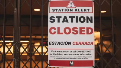
D.C. Metro Seeks Public Input on Proposed Service Cuts
D.C. Metro Seeks Public Input on Proposed Service Cuts
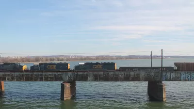
Key Virginia Rail Bridge Project Completes Environmental Review
A $1.9 billion project to add a second set of rail tracks to the Long Bridge that connects Virginia to D.C. is ready to move forward with a recently completed Environmental Impact Statement.

Alabama: Trump Terminates Settlements for Black Communities Harmed By Raw Sewage
Trump deemed the landmark civil rights agreement “illegal DEI and environmental justice policy.”

Planetizen Federal Action Tracker
A weekly monitor of how Trump’s orders and actions are impacting planners and planning in America.

The 120 Year Old Tiny Home Villages That Sheltered San Francisco’s Earthquake Refugees
More than a century ago, San Francisco mobilized to house thousands of residents displaced by the 1906 earthquake. Could their strategy offer a model for the present?

Ken Jennings Launches Transit Web Series
The Jeopardy champ wants you to ride public transit.

BLM To Rescind Public Lands Rule
The change will downgrade conservation, once again putting federal land at risk for mining and other extractive uses.

Indy Neighborhood Group Builds Temporary Multi-Use Path
Community members, aided in part by funding from the city, repurposed a vehicle lane to create a protected bike and pedestrian path for the summer season.
Urban Design for Planners 1: Software Tools
This six-course series explores essential urban design concepts using open source software and equips planners with the tools they need to participate fully in the urban design process.
Planning for Universal Design
Learn the tools for implementing Universal Design in planning regulations.
Clanton & Associates, Inc.
Jessamine County Fiscal Court
Institute for Housing and Urban Development Studies (IHS)
City of Grandview
Harvard GSD Executive Education
Toledo-Lucas County Plan Commissions
Salt Lake City
NYU Wagner Graduate School of Public Service