


The TransitScreen service has been around since 2012, but it’s latest product, real-time displays of all modes of transportation, can display in the public realm, providing a whole new level of interaction with the city.
For the uninitiated, “[TransitScreen] company’s digital signage aggregates real-time information for any mode of public transit in a city--subways, commuter trains, buses, bike share, ride shares--and displays this info in university buildings, the lobbies of apartment buildings and offices, and more,” according to the description of Fast Company Design writer Shaunacy Ferro.
Ferro’s recent article, however, explains TransitScreen’s latest product, SmartWalk. SmartWalk is a customizable, real-time information display that activates the public realm in more ways than one by displaying onto surfaces in the public realm,
The technology works similarly to RideScout, but has the unique benefit of being customizable to a specific location. For an example of how SmartWalk works, Ferro describes a display situated between the University of California, Berkeley campus and the downtown BART station, which will see an estimated three million people walk by a year. “It tells you exactly how many bikes are available at the nearby bike station, how many minutes it will take for a ridesharing service to pick you up, and, at some universities, when the nearest campus shuttle will arrive. The company is attempting to bring Uber and Lyft data into the fold as well.”
FULL STORY: SmartWalk Turns Any Surface Into A Subway Tracker

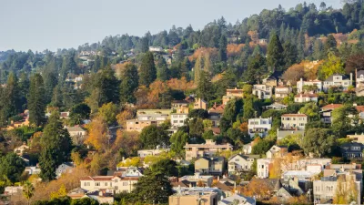
Berkeley Launches ADU Amnesty Program
Owners of unpermitted accessory dwelling units can bring their units up to code and obtain certificates of compliance without facing penalties.
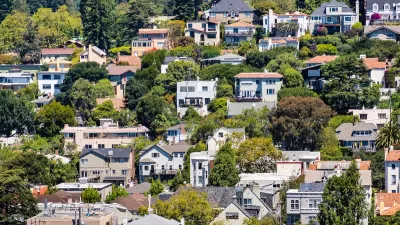
Birthplace of Single-Family Zoning Poised to Pass Upzoning Plan
Berkeley, California, pioneered exclusionary zoning in the early 1900s; with its new upzoning proposal, the city hopes to reverse that negative legacy and boost its housing supply by eliminating single-family zoning.

Berkeley Voters to Decide on Building Gas Tax
The city could tax large buildings that use gas in lieu of enacting a law that would have banned gas-powered buildings altogether.

Alabama: Trump Terminates Settlements for Black Communities Harmed By Raw Sewage
Trump deemed the landmark civil rights agreement “illegal DEI and environmental justice policy.”

Planetizen Federal Action Tracker
A weekly monitor of how Trump’s orders and actions are impacting planners and planning in America.

The 120 Year Old Tiny Home Villages That Sheltered San Francisco’s Earthquake Refugees
More than a century ago, San Francisco mobilized to house thousands of residents displaced by the 1906 earthquake. Could their strategy offer a model for the present?

Indy Neighborhood Group Builds Temporary Multi-Use Path
Community members, aided in part by funding from the city, repurposed a vehicle lane to create a protected bike and pedestrian path for the summer season.

Congestion Pricing Drops Holland Tunnel Delays by 65 Percent
New York City’s contentious tolling program has yielded improved traffic and roughly $100 million in revenue for the MTA.

In Both Crashes and Crime, Public Transportation is Far Safer than Driving
Contrary to popular assumptions, public transportation has far lower crash and crime rates than automobile travel. For safer communities, improve and encourage transit travel.
Urban Design for Planners 1: Software Tools
This six-course series explores essential urban design concepts using open source software and equips planners with the tools they need to participate fully in the urban design process.
Planning for Universal Design
Learn the tools for implementing Universal Design in planning regulations.
Clanton & Associates, Inc.
Jessamine County Fiscal Court
Institute for Housing and Urban Development Studies (IHS)
City of Grandview
Harvard GSD Executive Education
Toledo-Lucas County Plan Commissions
Salt Lake City
NYU Wagner Graduate School of Public Service