


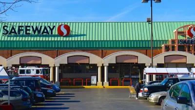
Angie Schmitt shares news of an effort by WalkScore to rank cities based on the ability of residents to access grocery stores on foot. WalkScore invites planners all over country to use their data to improve walkable access to food in cities.

A new article on Streetsblog USA by Angie Schmitt details a new ranking and visualization by WalScore, which complied data on the best and worst cities for walking to the grocery store. No surprise at the top—in New York City, 72 percent of its residents can access grocery stores in five minutes or less by walking.
Here’s how Sshmitt explains the methodology of the rankings: “Walk Score used its algorithm to cross-reference millions of walking routes with its database of grocery store locations. Then it ranked cities with populations over 500,000 according to the share of residents who can walk to a grocery store in five minutes.”
The visualization—and Schmitt’s coverage of the rankings—are meant in part to inspire cities to collaborate with WalkScore in working to improve pedestrian access to grocery stores. In fact, “[cities] including San Jose, California, are using tools from Walk Score to examine and address local food access issues."
FULL STORY: The 5 Cities Where It’s Easiest — and Hardest — to Walk to the Grocery Store

What's Wrong With Walk Score's Food Desert Map
Walk Score’s new food desert map is a potentially powerful tool in the ongoing policy debate about access to healthy foods. But it’s still a work in progress.
'Grocery Walk' Gathers D.C. Residents to Bring Attention to Lack of Food Options
Neighborhoods with mostly minority populations in Washington, D.C. suffer from a lack of quality grocery stores. A large group of neighborhood activists are trying to do something about it.
Mapping Grocery Store Closures around New York City
Thought eh majority of grocery stores that have closed in New York City recent years were located in Brooklyn, the issue still spreads far and wide through the city's boroughs.

Trump Administration Could Effectively End Housing Voucher Program
Federal officials are eyeing major cuts to the Section 8 program that helps millions of low-income households pay rent.

Planetizen Federal Action Tracker
A weekly monitor of how Trump’s orders and actions are impacting planners and planning in America.

Ken Jennings Launches Transit Web Series
The Jeopardy champ wants you to ride public transit.

California Invests Additional $5M in Electric School Buses
The state wants to electrify all of its school bus fleets by 2035.

Austin Launches $2M Homelessness Prevention Fund
A new grant program from the city’s Homeless Strategy Office will fund rental assistance and supportive services.

Alabama School Forestry Initiative Brings Trees to Schoolyards
Trees can improve physical and mental health for students and commnity members.
Urban Design for Planners 1: Software Tools
This six-course series explores essential urban design concepts using open source software and equips planners with the tools they need to participate fully in the urban design process.
Planning for Universal Design
Learn the tools for implementing Universal Design in planning regulations.
Ada County Highway District
Clanton & Associates, Inc.
Jessamine County Fiscal Court
Institute for Housing and Urban Development Studies (IHS)
City of Grandview
Harvard GSD Executive Education
Toledo-Lucas County Plan Commissions
Salt Lake City
NYU Wagner Graduate School of Public Service