


“A City of Neighborhoods,” a new exhibit at the Boston Public Library, uses maps to illustrate how waves of immigration shaped the city and its neighborhoods throughout the 20th century.
Greg Miller provides a preview of a new exhibition at the Boston Public Library called “A City of Neighborhoods.” “The idea is to look at Boston as a whole, but then to zero in on certain neighborhoods and see what those stories are,” says Michelle LeBlanc, director of education at the library’s Norman B. Leventhal Map Center, when quoted in the article.
Immigration has driven many of Boston’s population trends in the past century. Here Miller describes some of the population changes, and how some Boston neighborhoods remain diverse: “The percentage of foreign-born residents is lower than it used to be: 27 percent, compared to 36 percent in 1910. But some neighborhoods are still remarkably diverse. East Boston’s population is almost 50 percent foreign born, the highest percentage of any neighborhood in the city.”
As for an example of a neighborhood that has experienced immigration-driven changes: “The exhibit includes a brochure from 1910 advertising a new planned neighborhood, ‘Orient Heights,’ built on landfill [an] area of East Boston that was once covered by marshland. ‘They were trying to entice immigrant families from the slums of the West End and North End because there’s open space and fresh air and all that,’ LeBlanc said. Contrary to the development’s name, LeBlanc says the biggest immigrant groups at that time were Italians and Eastern European Jews. Today the biggest immigrant groups in the neighborhood are from El Salvador and Columbia.”
The exhibition stays away, however, from the touchy political subject of gentrification.
FULL STORY: Maps Reveal How Immigration Transformed Boston’s Neighborhoods

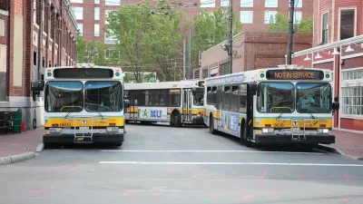
Boston Bus Signal Priority Project Yields Faster Travel Times
The city now plans to expand a year-long pilot project that reduced the time buses waited at traffic signals.

DOT Memo Directs Transportation Funding to Communities With Higher Marriage and Birth Rates, Compliance with Immigration Officials and No Mask Mandates
The memo ties immigration enforcement to federal funding and prohibits mask or vaccine mandates.
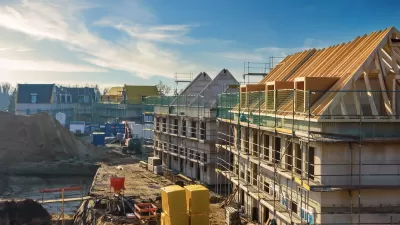
How Might Tariffs and Deportations Affect Affordable Housing Development?
Many affordable housing developers worry Trump’s proposed taxes on imports and crackdown on immigration will be detrimental to the industry. Others hope deregulation reduces development costs enough to offset those effects. What’s the most likely outcome?

Study: Maui’s Plan to Convert Vacation Rentals to Long-Term Housing Could Cause Nearly $1 Billion Economic Loss
The plan would reduce visitor accommodation by 25,% resulting in 1,900 jobs lost.

North Texas Transit Leaders Tout Benefits of TOD for Growing Region
At a summit focused on transit-oriented development, policymakers discussed how North Texas’ expanded light rail system can serve as a tool for economic growth.

Why Should We Subsidize Public Transportation?
Many public transit agencies face financial stress due to rising costs, declining fare revenue, and declining subsidies. Transit advocates must provide a strong business case for increasing public transit funding.

How to Make US Trains Faster
Changes to boarding platforms and a switch to electric trains could improve U.S. passenger rail service without the added cost of high-speed rail.

Columbia’s Revitalized ‘Loop’ Is a Hub for Local Entrepreneurs
A focus on small businesses is helping a commercial corridor in Columbia, Missouri thrive.

Invasive Insect Threatens Minnesota’s Ash Forests
The Emerald Ash Borer is a rapidly spreading invasive pest threatening Minnesota’s ash trees, and homeowners are encouraged to plant diverse replacement species, avoid moving ash firewood, and monitor for signs of infestation.
Urban Design for Planners 1: Software Tools
This six-course series explores essential urban design concepts using open source software and equips planners with the tools they need to participate fully in the urban design process.
Planning for Universal Design
Learn the tools for implementing Universal Design in planning regulations.
Ascent Environmental
Borough of Carlisle
Institute for Housing and Urban Development Studies (IHS)
City of Grandview
Harvard GSD Executive Education
Toledo-Lucas County Plan Commissions
Salt Lake City
NYU Wagner Graduate School of Public Service