


Are your local planning tools supporting a thriving and resilient future? Andrew von Maur shares a little inspiration from Las Cruces, New Mexico.
"Crossing Campo Street from downtown Las Cruces into the Mesquite Historic District is like crossing between two urban worlds that are often misunderstood."
"To the west is one of the country’s textbook examples of everything that could go wrong with federally subsidized Urban Renewal, including the obligatory seas of parking, corporate CBD architecture, vacant properties, and a one-way loop that locals derisively refer to as “the race track.” The stunning aerial view from 1974 shows the city after its failed open-heart surgery. Even today, after a heroic struggle to dismantle the virtually abandoned pedestrian mall and reinstitute automobile-access on Main Street, the pain of this flattening experience lingers on. The place is deserted on a beautiful September evening."
"To the east, Mesquite escaped most of the bulldozers and still faces Campo Street with modest but charming one-story adobes. It is the original town site along the Camino Real and was platted in 1849 by New Mexicans from nearby Doña Ana — a truly traditional neighborhood lived in by more than twenty of the original settler families. In contrast to downtown, the streets here are narrow with few parking lots, lined by modest one-room-wide adobe boxes with portales, small shop fronts, and garden walls. Age has given it character — at times picturesque, at times desperate for care. But unlike the city center, Mesquite is alive."
Von Maur goes on to share key insights to resilient urbanism, along with an inspiring photo journal of Mesquite.
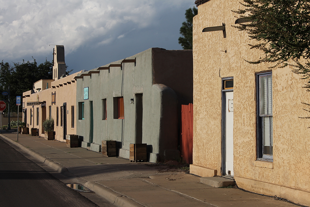
Mesquite Neighborhood in Las Cruces, New Mexico. Image credit: Andrew von Maur, Creative Commons ShareAlike Licensing
FULL STORY: Let Love Rule: Resilience in Mesquite

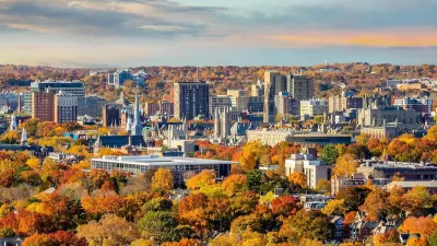
New Haven Reaches for Reinvention Amidst Failures of Urban Renewal
Seeking recovery from decades of failed urban renewal projects, New Haven rings in the new year by continuing a series of small-scale urban planning initiatives to reinvent its municipal spaces.
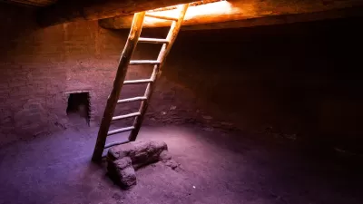
The Meaning of Ruins on the Landscape
In the latest in a far ranging series of interest to planners—centered on contrasts between urban and natural environments—Chuck Wolfe speculates about the role of ruins in urban and natural environments.
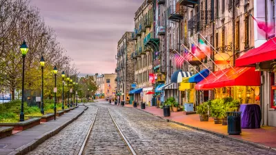
Savannah: A City of Planning Contrasts
From a human-scales, plaza-anchored grid to suburban sprawl, the oldest planned city in the United States has seen wildly different development patterns.

Alabama: Trump Terminates Settlements for Black Communities Harmed By Raw Sewage
Trump deemed the landmark civil rights agreement “illegal DEI and environmental justice policy.”

Study: Maui’s Plan to Convert Vacation Rentals to Long-Term Housing Could Cause Nearly $1 Billion Economic Loss
The plan would reduce visitor accommodation by 25% resulting in 1,900 jobs lost.

Planetizen Federal Action Tracker
A weekly monitor of how Trump’s orders and actions are impacting planners and planning in America.

Wind Energy on the Rise Despite Federal Policy Reversal
The Trump administration is revoking federal support for renewable energy, but demand for new projects continues unabated.

Passengers Flock to Caltrain After Electrification
The new electric trains are running faster and more reliably, leading to strong ridership growth on the Bay Area rail system.

Texas Churches Rally Behind ‘Yes in God’s Back Yard’ Legislation
Religious leaders want the state to reduce zoning regulations to streamline leasing church-owned land to housing developers.
Urban Design for Planners 1: Software Tools
This six-course series explores essential urban design concepts using open source software and equips planners with the tools they need to participate fully in the urban design process.
Planning for Universal Design
Learn the tools for implementing Universal Design in planning regulations.
Caltrans
Smith Gee Studio
Institute for Housing and Urban Development Studies (IHS)
City of Grandview
Harvard GSD Executive Education
Toledo-Lucas County Plan Commissions
Salt Lake City
NYU Wagner Graduate School of Public Service