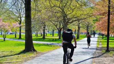
Advanced remote sensing technologies are providing cities and planners across the United States with new tools to assess urban tree canopy and develop more effective urban reforestation efforts.
"Researchers at the University of Vermont’s Spatial Analysis Lab and the USDA Forest Service’s Northern Research Station are working with cities to leverage existing terrain data gathered using LiDAR (light detection and ranging) technology in order to assess tree canopies," reports Liz McEnaney. "This LiDAR technology allows for an accuracy not provided by aerial and satellite images in which trees are frequently obscured by building shadows."
"These maps are overlaid with census reports, demographics, property records, and other datasets that allow cities and not-for-profits to prioritize tree-planting efforts and tree maintenance plans, but also to understand patterns of environmental justice and to justify budget increases for urban forestry programs."
FULL STORY: PLANT BY NUMBERS

Alabama: Trump Terminates Settlements for Black Communities Harmed By Raw Sewage
Trump deemed the landmark civil rights agreement “illegal DEI and environmental justice policy.”

Study: Maui’s Plan to Convert Vacation Rentals to Long-Term Housing Could Cause Nearly $1 Billion Economic Loss
The plan would reduce visitor accommodation by 25% resulting in 1,900 jobs lost.

Planetizen Federal Action Tracker
A weekly monitor of how Trump’s orders and actions are impacting planners and planning in America.

Wind Energy on the Rise Despite Federal Policy Reversal
The Trump administration is revoking federal support for renewable energy, but demand for new projects continues unabated.

Passengers Flock to Caltrain After Electrification
The new electric trains are running faster and more reliably, leading to strong ridership growth on the Bay Area rail system.

Texas Churches Rally Behind ‘Yes in God’s Back Yard’ Legislation
Religious leaders want the state to reduce zoning regulations to streamline leasing church-owned land to housing developers.
Urban Design for Planners 1: Software Tools
This six-course series explores essential urban design concepts using open source software and equips planners with the tools they need to participate fully in the urban design process.
Planning for Universal Design
Learn the tools for implementing Universal Design in planning regulations.
Caltrans
Smith Gee Studio
Institute for Housing and Urban Development Studies (IHS)
City of Grandview
Harvard GSD Executive Education
Toledo-Lucas County Plan Commissions
Salt Lake City
NYU Wagner Graduate School of Public Service


