


A new study has quantified how Baron Georges-Eugene Haussmann's plans changed the form and function of Paris - a topic that had previously been open to the subjective analysis of urban theorists. The results might surprise you.
"[A] new study by a collaboration of mathematical physicists and social historians in France shows that, simply by analysing old and new maps of the city, it’s possible to quantify what effect Haussmann’s plans had on the shape and life of Paris," reports Philip Ball. "The results offer a case history of how cities may evolve through a combination of spontaneous self-organisation and top-down central planning."
"Marc Barthelemy of the CEA Institute of Theoretical Physics in the Parisian suburb of Gif-sur-Yvette and his colleagues have analysed maps of the city road network at six moments in time since the Revolution began: 1789, 1826, 1836, 1888, 1999 and 2010. They looked at some basic properties of the networks, such as the numbers of nodes (intersections) and edges (roads between intersections), as well as using more sophisticated concepts from the modern theory of complex networks, such as the quantity called 'betweenness centrality' (BC) that measures the importance of individual nodes to navigating the network."
"The results are revealing," says Ball. "Whether or not Haussmann made a difference depends on what you look at."
FULL STORY: The revolution that built the streets of Paris


France Tightens Restrictions on Short-Term Rentals
The vacation rental market is shouldering part of the blame for rising housing costs, particularly in popular tourist destinations.
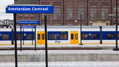
Eurostar Temporarily Closing Two High-Speed Rail Routes
Eurostar is temporarily closing routes from London to Disneyland Paris and London to Amsterdam.
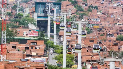
Paris Approves First Aerial Gondola
An aerial tramway project in the French capital cleared feasibility studies and could open in 2025.

Alabama: Trump Terminates Settlements for Black Communities Harmed By Raw Sewage
Trump deemed the landmark civil rights agreement “illegal DEI and environmental justice policy.”

Planetizen Federal Action Tracker
A weekly monitor of how Trump’s orders and actions are impacting planners and planning in America.

The 120 Year Old Tiny Home Villages That Sheltered San Francisco’s Earthquake Refugees
More than a century ago, San Francisco mobilized to house thousands of residents displaced by the 1906 earthquake. Could their strategy offer a model for the present?

Indy Neighborhood Group Builds Temporary Multi-Use Path
Community members, aided in part by funding from the city, repurposed a vehicle lane to create a protected bike and pedestrian path for the summer season.

Congestion Pricing Drops Holland Tunnel Delays by 65 Percent
New York City’s contentious tolling program has yielded improved traffic and roughly $100 million in revenue for the MTA.

In Both Crashes and Crime, Public Transportation is Far Safer than Driving
Contrary to popular assumptions, public transportation has far lower crash and crime rates than automobile travel. For safer communities, improve and encourage transit travel.
Urban Design for Planners 1: Software Tools
This six-course series explores essential urban design concepts using open source software and equips planners with the tools they need to participate fully in the urban design process.
Planning for Universal Design
Learn the tools for implementing Universal Design in planning regulations.
Clanton & Associates, Inc.
Jessamine County Fiscal Court
Institute for Housing and Urban Development Studies (IHS)
City of Grandview
Harvard GSD Executive Education
Toledo-Lucas County Plan Commissions
Salt Lake City
NYU Wagner Graduate School of Public Service