


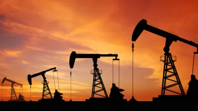
What's the most productive way to utilize the fertile land that sits above California's vast Monterey Shale oil reserve? The environmental impacts of fracking on California's farmland could derail what promises to be an enormous oil boom.
"Driven by advances in drilling technology and high oil prices, oil companies are increasingly moving into traditionally agricultural areas like Shafter that make up one of the world’s most fertile regions but also lie above a huge untapped oil reserve called the Monterey Shale," reports Norimitsu Onishi.
"By all accounts, oilmen and farmers — often shortened to 'oil and ag' here — have coexisted peacefully for decades in this conservative, business friendly part of California about 110 miles northwest of Los Angeles. But oil’s push into new areas and its increasing reliance on fracking, which uses vast amounts of water and chemicals that critics say could contaminate groundwater, are testing that relationship and complicating the continuing debate over how to regulate fracking in California."
“'We’re just seeing the tip of the iceberg of what’s coming,' said [Rex Parris, Mayor of Lancaster] of the drilling for Monterey Shale oil here. 'It could enrich the state beyond belief, but it could also destroy it.'”
FULL STORY: Fracking Tests Ties Between California ‘Oil and Ag’ Interests

West Texas Drilling Boom Bodes Ill for Residents, the Planet
Driven by foreign demand, a surge in West Texas oil production is having adverse effects on the local populace, and contributes to climate change at a crucial moment.

Voters to Decide on Repair of Vital Aqueduct for San Joaquin Valley
California voters in November will have the opportunity to help repair the Friant-Kern Canal, damaged by subsidence, as well as invest in watershed conservation programs, by passing a citizen-initiated $8.9 billion general obligation bond measure.
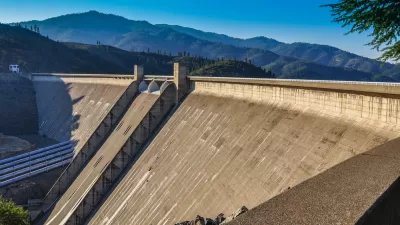
Why Are the Feds Suddenly in Favor of Raising the Shasta Dam?
Despite state opposition and potential violations of California law, the Trump Administration has revived a project that was deemed impracticable only a few years ago.

Alabama: Trump Terminates Settlements for Black Communities Harmed By Raw Sewage
Trump deemed the landmark civil rights agreement “illegal DEI and environmental justice policy.”

Planetizen Federal Action Tracker
A weekly monitor of how Trump’s orders and actions are impacting planners and planning in America.

The 120 Year Old Tiny Home Villages That Sheltered San Francisco’s Earthquake Refugees
More than a century ago, San Francisco mobilized to house thousands of residents displaced by the 1906 earthquake. Could their strategy offer a model for the present?

Ken Jennings Launches Transit Web Series
The Jeopardy champ wants you to ride public transit.

BLM To Rescind Public Lands Rule
The change will downgrade conservation, once again putting federal land at risk for mining and other extractive uses.

Indy Neighborhood Group Builds Temporary Multi-Use Path
Community members, aided in part by funding from the city, repurposed a vehicle lane to create a protected bike and pedestrian path for the summer season.
Urban Design for Planners 1: Software Tools
This six-course series explores essential urban design concepts using open source software and equips planners with the tools they need to participate fully in the urban design process.
Planning for Universal Design
Learn the tools for implementing Universal Design in planning regulations.
Clanton & Associates, Inc.
Jessamine County Fiscal Court
Institute for Housing and Urban Development Studies (IHS)
City of Grandview
Harvard GSD Executive Education
Toledo-Lucas County Plan Commissions
Salt Lake City
NYU Wagner Graduate School of Public Service