


A new study by the Chicago-based Center for Neighborhood Technology (CNT) compares that city's flood insurance claims with its floodplains, and finds a 'completely counter-intuitive' relationship between the two.
Common sense would lead one to imagine the bulk of Chicago's flood insurance claims would occur in those areas most prone to flooding. But what may seem logical to the average person, or "even the average expert in flooding," is incorrect, says a new report [PDF] authored by Harriet Festing, CNT's water program director. And as Emily Badger explains, impervious surfaces are to blame.
"Chicago – and plenty of other cities just like it – has artificially created flood-prone places simply by paving over the region's natural ability to manage excess water. And, as Festing points out, most people are entirely unaware that the city has done this. In urban areas anywhere, when we focus instead on the risks posed by flood plains, we may be ignoring the even greater threat created by how we've designed cities to crowd out their essential green space," says Badger.
FULL STORY: The Way We Build Cities Is Making Them Flood

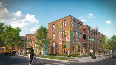
Museum of Public Housing Opens in Chicago
The museum highlights the history of public housing in the United States using displays intimately woven with family artifacts.
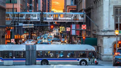
Chicago Transit Agencies on Brink of Major Crisis
Without additional funding, regional transit agencies will be forced to cut services by 40 percent.

Study: Most Chicago Rideshare Trips Could Be Made by Transit
Researchers found that 99 percent of rideshare trips could be made by buses and trains — but the time savings roughly equal an hour’s wage.

Alabama: Trump Terminates Settlements for Black Communities Harmed By Raw Sewage
Trump deemed the landmark civil rights agreement “illegal DEI and environmental justice policy.”

Planetizen Federal Action Tracker
A weekly monitor of how Trump’s orders and actions are impacting planners and planning in America.

The 120 Year Old Tiny Home Villages That Sheltered San Francisco’s Earthquake Refugees
More than a century ago, San Francisco mobilized to house thousands of residents displaced by the 1906 earthquake. Could their strategy offer a model for the present?

Ken Jennings Launches Transit Web Series
The Jeopardy champ wants you to ride public transit.

BLM To Rescind Public Lands Rule
The change will downgrade conservation, once again putting federal land at risk for mining and other extractive uses.

Indy Neighborhood Group Builds Temporary Multi-Use Path
Community members, aided in part by funding from the city, repurposed a vehicle lane to create a protected bike and pedestrian path for the summer season.
Urban Design for Planners 1: Software Tools
This six-course series explores essential urban design concepts using open source software and equips planners with the tools they need to participate fully in the urban design process.
Planning for Universal Design
Learn the tools for implementing Universal Design in planning regulations.
Clanton & Associates, Inc.
Jessamine County Fiscal Court
Institute for Housing and Urban Development Studies (IHS)
City of Grandview
Harvard GSD Executive Education
Toledo-Lucas County Plan Commissions
Salt Lake City
NYU Wagner Graduate School of Public Service