


A speculative master plan for Chicago's West Loop would add a new layer to downtown's complex multi-level weaving of street strata and infrastructure with a highway cap park.
"In cooperation with developer Fifield Companies, [Scott] Sarver and his firm [smdp] have fleshed out a masterplan that calls for 10 million square feet of new office space in the West Loop in 10 years," reports Chris Bentley. "The plan also calls for a 10-to-15-acre park covering the trench of the Kennedy Expressway, which forms a barrier between the West Loop and downtown. Alan Schachtman, executive vice president of Fifield, called this hypothetical green a Millennium Park for the West Loop."
"Chicago’s downtown long ago spilled over the boundaries that traditionally defined the Loop, creating a 10-square-mile 'mega-Loop' with growth to rival any city in the country. Sarver said that, physically, the city will have to continue expanding west. Streeterville and River North are already developed, the South Loop lacks public transportation and accessibility compared to its western counterpart, Sarver said, and the area has a secret weapon: fiber optic cables."
FULL STORY: DECK THIS!

Downtown Residential Populations Catalogued and Compared
Nick Ian Emenhiser compares percent of city populations in their downtowns.
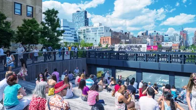
Parking Companies Fight Back Against Congestion Tax
Chicago Mayor Rahm Emanuel's plan to tax parking downtown is not the solution to a regional problem primarily affecting highways, the industry says.
"Over the Top": Downtown Chicago Considers Congestion Fee
While some may grudgingly eat the extra fee to park downtown on weekdays, others may look toward more reliance on the El--the desired response. But is a flat congestion fee on top of already existing parking rates the best way to go?

Alabama: Trump Terminates Settlements for Black Communities Harmed By Raw Sewage
Trump deemed the landmark civil rights agreement “illegal DEI and environmental justice policy.”

Planetizen Federal Action Tracker
A weekly monitor of how Trump’s orders and actions are impacting planners and planning in America.

The 120 Year Old Tiny Home Villages That Sheltered San Francisco’s Earthquake Refugees
More than a century ago, San Francisco mobilized to house thousands of residents displaced by the 1906 earthquake. Could their strategy offer a model for the present?

Ken Jennings Launches Transit Web Series
The Jeopardy champ wants you to ride public transit.

BLM To Rescind Public Lands Rule
The change will downgrade conservation, once again putting federal land at risk for mining and other extractive uses.

Indy Neighborhood Group Builds Temporary Multi-Use Path
Community members, aided in part by funding from the city, repurposed a vehicle lane to create a protected bike and pedestrian path for the summer season.
Urban Design for Planners 1: Software Tools
This six-course series explores essential urban design concepts using open source software and equips planners with the tools they need to participate fully in the urban design process.
Planning for Universal Design
Learn the tools for implementing Universal Design in planning regulations.
Clanton & Associates, Inc.
Jessamine County Fiscal Court
Institute for Housing and Urban Development Studies (IHS)
City of Grandview
Harvard GSD Executive Education
Toledo-Lucas County Plan Commissions
Salt Lake City
NYU Wagner Graduate School of Public Service