


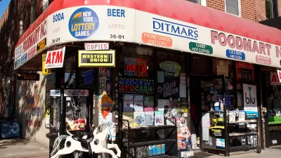
This Big City reviews a new book by urban designer Julie Campoli that explores the elements crucial to creating walkable places. "Simply having shops, services and venues within walking distance is not enough."
In "Made for Walking: Density and Neighborhood Form", published by the Lincoln Institute of Land Policy, Campoli performs a close read of 12 walkable neighbourhoods in the US and Canada, to explain the "key factors that combine to create truly walkable streets and communities." Looking beyond the mere proximity of destinations such as schools, shops, and restaurants, she identifies several other factors that "improve or reduce the walkability of a street or neighbourhood:
- Connections – a fine-grained network of sidewalks and footpaths with plenty of intersections;
- Tissue – Great architecture with small human-sized buildings, not big boxes!
- Density – of housing and population;
- Streetscape – well designed streets with wide sidewalks and crossings, that are easy and safe to walk in;
- Green networks – plenty of street trees and green spaces."
"The streets and communities profiled by Campoli also happen to be really beautiful and fun places to live and work. The books extensive use of street photography helps to illustrate why people are so happy to walk in these streets, in ways that pure statistics and analysis can never do justice."
FULL STORY: Why Walkability isn’t Just About Proximity to Shops

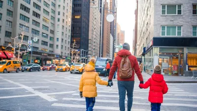
What the ‘Walk Score’ Misses
A popular walkability assessment omits key factors that impact different demographics and can direct development resources to already wealthy neighborhoods.
The Natalist Case For Sprawl (And Why It Fails)
Some commentators defend anti-urban government policies such as exclusionary zoning on the basis that homeowning suburbanites have high birth rates. But this doesn't seem to be true in recent decades.

North Texas Transit Leaders Tout Benefits of TOD for Growing Region
At a summit focused on transit-oriented development, policymakers discussed how North Texas’ expanded light rail system can serve as a tool for economic growth.

Alabama: Trump Terminates Settlements for Black Communities Harmed By Raw Sewage
Trump deemed the landmark civil rights agreement “illegal DEI and environmental justice policy.”

Planetizen Federal Action Tracker
A weekly monitor of how Trump’s orders and actions are impacting planners and planning in America.

The 120 Year Old Tiny Home Villages That Sheltered San Francisco’s Earthquake Refugees
More than a century ago, San Francisco mobilized to house thousands of residents displaced by the 1906 earthquake. Could their strategy offer a model for the present?

Indy Neighborhood Group Builds Temporary Multi-Use Path
Community members, aided in part by funding from the city, repurposed a vehicle lane to create a protected bike and pedestrian path for the summer season.

Congestion Pricing Drops Holland Tunnel Delays by 65 Percent
New York City’s contentious tolling program has yielded improved traffic and roughly $100 million in revenue for the MTA.

In Both Crashes and Crime, Public Transportation is Far Safer than Driving
Contrary to popular assumptions, public transportation has far lower crash and crime rates than automobile travel. For safer communities, improve and encourage transit travel.
Urban Design for Planners 1: Software Tools
This six-course series explores essential urban design concepts using open source software and equips planners with the tools they need to participate fully in the urban design process.
Planning for Universal Design
Learn the tools for implementing Universal Design in planning regulations.
Clanton & Associates, Inc.
Jessamine County Fiscal Court
Institute for Housing and Urban Development Studies (IHS)
City of Grandview
Harvard GSD Executive Education
Toledo-Lucas County Plan Commissions
Salt Lake City
NYU Wagner Graduate School of Public Service