


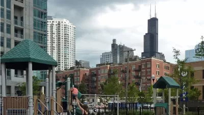
In Chicago, like in many cities, local food production comes in many forms, from small backyard crops to community gardens. Researchers are now using Google Earth to paint a more accurate picture of food production at different scales.
Cities are becoming increasingly interested in taking stock of “how much food is being produced within their limits," reports Sarah Zielinksi, adding, “[but they] can only guess at where exactly crops are growing.” After a frustrating attempt by graduate students at the University of Illinois at Urbana-Champaign to verify a list of 1,200 supposed community garden projects in Chicago found only 13 percent of the sites were used to grow food, graduate student John Taylor turned to Google Earth for help.
"Taylor found 4,648 sites with signs of food production — like rows of plants — covering more than 65 acres in total. Visits to a selection of those sites confirmed that 86 percent were actual places of food production."
Why this confusion? "Urban agriculture is sometimes thought of as something new and trendy, but of course people have been growing food in backyards and on vacant land for generations," Taylor says. "From a planning and policy perspective, we have to consider food production at multiple scales."
Taylor's Google-aided data is being used to develop the Chicago Urban Agriculture Mapping Project (CUAMP), a catalog of all of the city's agricultural sites.
FULL STORY: How Google Earth Revealed Chicago's Hidden Farms

Scaling Up Local, Sustainable Food Production
The local food production industry so far has mostly been constrained to a niche market—expensive and available only to a small percentage of consumers. A project in Portland is working to change that.
A Central Hub for Open Data
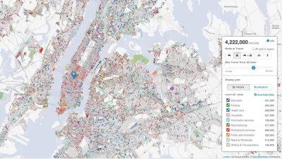
Designed by researchers at the University of Chicago, the Plenario platform gathers all available open data for a specific area. Then it presents the data in an easy-to-use format.
The Man Who Made Chicago Easy to Navigate
Edward Brennan waged an extended turn-of-the-century campaign to clean up Chicago's then-confusing address numbering system. Though few recognize his name, Brennan's legacy lives on in modern Chicago.

Alabama: Trump Terminates Settlements for Black Communities Harmed By Raw Sewage
Trump deemed the landmark civil rights agreement “illegal DEI and environmental justice policy.”

Study: Maui’s Plan to Convert Vacation Rentals to Long-Term Housing Could Cause Nearly $1 Billion Economic Loss
The plan would reduce visitor accommodation by 25% resulting in 1,900 jobs lost.

Planetizen Federal Action Tracker
A weekly monitor of how Trump’s orders and actions are impacting planners and planning in America.

Wind Energy on the Rise Despite Federal Policy Reversal
The Trump administration is revoking federal support for renewable energy, but demand for new projects continues unabated.

Passengers Flock to Caltrain After Electrification
The new electric trains are running faster and more reliably, leading to strong ridership growth on the Bay Area rail system.

Texas Churches Rally Behind ‘Yes in God’s Back Yard’ Legislation
Religious leaders want the state to reduce zoning regulations to streamline leasing church-owned land to housing developers.
Urban Design for Planners 1: Software Tools
This six-course series explores essential urban design concepts using open source software and equips planners with the tools they need to participate fully in the urban design process.
Planning for Universal Design
Learn the tools for implementing Universal Design in planning regulations.
Caltrans
Smith Gee Studio
Institute for Housing and Urban Development Studies (IHS)
City of Grandview
Harvard GSD Executive Education
Toledo-Lucas County Plan Commissions
Salt Lake City
NYU Wagner Graduate School of Public Service