


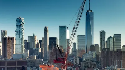
If you were confused by recent census data that named four California metros, including Delano (pop 53,819), as the most dense in America, a new report that looks at "population-weighted density" may deliver more satisfying results.
Richard Florida parses the findings included in a new report [PDF] published by the U.S. Census Bureau that provides a more nuanced look at the densities of America's metros. The new data measures population-weighted density, the concentration of people within a metro, which Florida believes is "an important improvement on
the standard measure of density." While average density simply divides the total population of a city or metro area by its land area, population-weighted density can provide a more detailed picture of density at varying distances from a city's center by looking at the densities of separate census tracts.
"New York and Los Angeles are good examples of the differences between
these two density measures," says Florida. "While they are close in the average density -
2,826 for New York versus 2,646 for L.A. - the New York metro has much
higher levels of concentrated or population-weighted density, 31,251
versus 12,114 people per square mile. San Francisco, which has lower
average density than L.A. (1,755 people per square mile), tops L.A. on
population-weighted density with 12,145 people per square mile."
FULL STORY: America's Truly Densest Metros


North Texas Transit Leaders Tout Benefits of TOD for Growing Region
At a summit focused on transit-oriented development, policymakers discussed how North Texas’ expanded light rail system can serve as a tool for economic growth.
Lawsuit Aims to Stop NYC’s ‘City of Yes’ Zoning Reforms
A lawsuit brought by local lawmakers and community groups claims the plan failed to conduct a comprehensive environmental review.

Connecticut Assembly to Reconsider TOD Bill
The ‘Work, Live, Ride’ bill would prioritize funding for designated transit-oriented zones to encourage denser development near transit.

Alabama: Trump Terminates Settlements for Black Communities Harmed By Raw Sewage
Trump deemed the landmark civil rights agreement “illegal DEI and environmental justice policy.”

Planetizen Federal Action Tracker
A weekly monitor of how Trump’s orders and actions are impacting planners and planning in America.

The 120 Year Old Tiny Home Villages That Sheltered San Francisco’s Earthquake Refugees
More than a century ago, San Francisco mobilized to house thousands of residents displaced by the 1906 earthquake. Could their strategy offer a model for the present?

Ken Jennings Launches Transit Web Series
The Jeopardy champ wants you to ride public transit.

BLM To Rescind Public Lands Rule
The change will downgrade conservation, once again putting federal land at risk for mining and other extractive uses.

Indy Neighborhood Group Builds Temporary Multi-Use Path
Community members, aided in part by funding from the city, repurposed a vehicle lane to create a protected bike and pedestrian path for the summer season.
Urban Design for Planners 1: Software Tools
This six-course series explores essential urban design concepts using open source software and equips planners with the tools they need to participate fully in the urban design process.
Planning for Universal Design
Learn the tools for implementing Universal Design in planning regulations.
Clanton & Associates, Inc.
Jessamine County Fiscal Court
Institute for Housing and Urban Development Studies (IHS)
City of Grandview
Harvard GSD Executive Education
Toledo-Lucas County Plan Commissions
Salt Lake City
NYU Wagner Graduate School of Public Service