


Ever wonder how the greenhouse gas emissions of your home compare to your neighbor's, or the supermarket down the street, or the office tower you work in? New software helps visualize such information in three dimensions across an entire city.
Developed by researchers at Arizona State University, the Hestia Project makes dramatically clear the comparative greenhouse gas emissions of a city's energy users, "right down to its individual buildings and roadways," explains Emily Badger.
One of the project's key advances is that, "[t]he software corrals publicly available data wholly unrelated to climate
change. That includes property tax filings that reveal the size and age
of buildings, how they're used and what fuel heats them, DMV records on
auto maintenance and inspections, and Metropolitan Planning
Organization traffic count estimates."
"The researchers have begun to test the software in Phoenix and Los
Angeles as well," notes Badger, "and [Kevin Gurney, an associate professor in ASU's School of Life Sciences and a senior scientist with the Global Institute of Sustainability] imagines that it would be particularly
useful to city managers trying to figure out how to target limited
resources toward the emissions sources with the greatest potential for
reductions."
FULL STORY: Watch a City Aglow in Greenhouse Gas Emissions

The United Nations Studies Urban Emissions Monitoring
Urban emissions researchers have been invited to speak at the UN Climate Conference in Lima. Their findings: through focused and networked monitoring, cities can make real inroads on cutting carbon.
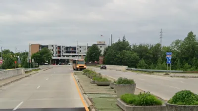
Indy Neighborhood Group Builds Temporary Multi-Use Path
Community members, aided in part by funding from the city, repurposed a vehicle lane to create a protected bike and pedestrian path for the summer season.
Ratepayers Could Be on the Hook for Data Centers’ Energy Use
Without regulatory changes, data centers’ high demand for energy would be subsidized by taxpayers, according to a new study.

Alabama: Trump Terminates Settlements for Black Communities Harmed By Raw Sewage
Trump deemed the landmark civil rights agreement “illegal DEI and environmental justice policy.”

Planetizen Federal Action Tracker
A weekly monitor of how Trump’s orders and actions are impacting planners and planning in America.

The 120 Year Old Tiny Home Villages That Sheltered San Francisco’s Earthquake Refugees
More than a century ago, San Francisco mobilized to house thousands of residents displaced by the 1906 earthquake. Could their strategy offer a model for the present?

Ken Jennings Launches Transit Web Series
The Jeopardy champ wants you to ride public transit.

BLM To Rescind Public Lands Rule
The change will downgrade conservation, once again putting federal land at risk for mining and other extractive uses.

Indy Neighborhood Group Builds Temporary Multi-Use Path
Community members, aided in part by funding from the city, repurposed a vehicle lane to create a protected bike and pedestrian path for the summer season.
Urban Design for Planners 1: Software Tools
This six-course series explores essential urban design concepts using open source software and equips planners with the tools they need to participate fully in the urban design process.
Planning for Universal Design
Learn the tools for implementing Universal Design in planning regulations.
Clanton & Associates, Inc.
Jessamine County Fiscal Court
Institute for Housing and Urban Development Studies (IHS)
City of Grandview
Harvard GSD Executive Education
Toledo-Lucas County Plan Commissions
Salt Lake City
NYU Wagner Graduate School of Public Service