


Peter Hermann describes the police force's efforts in D.C.'s up-and-coming areas to put a stop to crime and congestion before it even occurs.
The revitalization of an area or community is often seen as an effective means to reduce crime, but could this process actually draw in the very thing it is meant to discourage? D.C. Police Chief Cathy L. Lanier has begun using real estate trends to predict and prevent crime in redeveloping areas of the city, which can be vulnerable to crowding, traffic and criminal activities. Says Hermann, "Economic development data can be as important in shaping police staffing decisions as armed-robbery statistics."
Lanier has recently targeted H Street in Northeast, and Columbia Heights and the U Street corridor in Northwest, due to increases in robberies and nuisance crimes as the areas redevelop, displacing the drug-dealing and prostitution that was taking place.
Why doesn't redevelopment make policing easier? "One reason redevelopment challenges police is that it doesn't happen all at once," writes Hermann. "Along H Street NE, for instance, the bars, dance studio, restaurants and clubs are still next to boarded-up buildings."
Lanier intends to resolve these shortcomings by utilizing the data at hand to project future outcomes. "Ultimately, it's a complete shift in standards, regulations, transportation, policing and public safety. If we know where the development is, we can predict a little better and put things in place to prevent crimes from popping up in those places."
FULL STORY: D.C. police measure up-and-coming neighborhoods

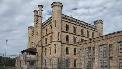
‘Shawshank Redemption’: 5 Adaptive Reuse Strategies for Shuttered Jails
Redeveloping closed correctional facilities in ways that foster just and thriving communities is a growing trend across the United States.
Preservation and Redevelopment Can Work Hand in Hand
While historic preservation is often perceived to be a hinderance to development efforts, preserving buildings actually helps economic development, say advocates.
What do Californians Want From Government?
CA Speaker of the Assembly John Pérez discusses the current challenges faced by government in California, drawing particular attention to the struggle for consensus on how the State should support economic development at the local level. (VIDEO)

Alabama: Trump Terminates Settlements for Black Communities Harmed By Raw Sewage
Trump deemed the landmark civil rights agreement “illegal DEI and environmental justice policy.”

Planetizen Federal Action Tracker
A weekly monitor of how Trump’s orders and actions are impacting planners and planning in America.

The 120 Year Old Tiny Home Villages That Sheltered San Francisco’s Earthquake Refugees
More than a century ago, San Francisco mobilized to house thousands of residents displaced by the 1906 earthquake. Could their strategy offer a model for the present?

Indy Neighborhood Group Builds Temporary Multi-Use Path
Community members, aided in part by funding from the city, repurposed a vehicle lane to create a protected bike and pedestrian path for the summer season.

Congestion Pricing Drops Holland Tunnel Delays by 65 Percent
New York City’s contentious tolling program has yielded improved traffic and roughly $100 million in revenue for the MTA.

In Both Crashes and Crime, Public Transportation is Far Safer than Driving
Contrary to popular assumptions, public transportation has far lower crash and crime rates than automobile travel. For safer communities, improve and encourage transit travel.
Urban Design for Planners 1: Software Tools
This six-course series explores essential urban design concepts using open source software and equips planners with the tools they need to participate fully in the urban design process.
Planning for Universal Design
Learn the tools for implementing Universal Design in planning regulations.
Clanton & Associates, Inc.
Jessamine County Fiscal Court
Institute for Housing and Urban Development Studies (IHS)
City of Grandview
Harvard GSD Executive Education
Toledo-Lucas County Plan Commissions
Salt Lake City
NYU Wagner Graduate School of Public Service