


Geoff Dyer points out why the difference between the typical strip mall and the multi-way boulevard may be more subtle than you think.
According to Dyer, "Like its larger cousin the mall, the strip mall has become a symbol for our dysfunctional car-focused suburban environments. Ask any born-again urbanite why, and they'll tell you that the strip mall's most damning offense is putting all that parking in front of the store, creating a horrible car-focused environment. But is it so simple? Take that same urbanite to some of the celebrated boulevards of Paris, Barcelona, or even Chico, California and see those offenses forgiven."
Dyer goes on to explain the similarities between the arterial corridor lined with strip malls and the multi-way boulevard, and the key difference - the boulevard's "connected, high-quality pedestrian realm linking multiple properties." He also explores how North American urban designers might talk transportation engineers into letting them make more beloved places by moving from heavy arterial usage into a multi-way boulevard urban ordering system.
"To conclude, I ask the rhetorical question. If there are only subtle differences between the ingredients of the two roadways, there are many successfully built boulevards, and there are far, far more advantages of the multi-way boulevard over the arterial, then why are we still building miles of big dumb arterial streets while our multi-way boulevards are kept locked in the broom closet like Cinderella?"
Dyer wraps up with a list of things that might help you get a multi-way boulevard built locally.
Thanks to Hazel Borys
FULL STORY: The Strip Mall vs. the Multi-Way Boulevard: In Consideration of Subtle Differences


Austin Suburb Launches Walkability Study
Kyle, Texas is developing a Sidewalks Master Plan to improve walking facilities.
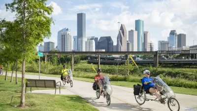
Houston Developers Question Mayor’s Stance on Pedestrian Projects
The new mayor’s reversal of road safety projects, some already underway or completed, is raising eyebrows among developers who say residents want walkable, mixed-use streets.
Meet NYC’s New Office of Livable Streets
The NYC DOT program will build on pandemic-era initiatives to promote safe and comfortable streets that enhance community and expand uses beyond just moving cars.

Alabama: Trump Terminates Settlements for Black Communities Harmed By Raw Sewage
Trump deemed the landmark civil rights agreement “illegal DEI and environmental justice policy.”

Planetizen Federal Action Tracker
A weekly monitor of how Trump’s orders and actions are impacting planners and planning in America.

The 120 Year Old Tiny Home Villages That Sheltered San Francisco’s Earthquake Refugees
More than a century ago, San Francisco mobilized to house thousands of residents displaced by the 1906 earthquake. Could their strategy offer a model for the present?

Indy Neighborhood Group Builds Temporary Multi-Use Path
Community members, aided in part by funding from the city, repurposed a vehicle lane to create a protected bike and pedestrian path for the summer season.

Congestion Pricing Drops Holland Tunnel Delays by 65 Percent
New York City’s contentious tolling program has yielded improved traffic and roughly $100 million in revenue for the MTA.

In Both Crashes and Crime, Public Transportation is Far Safer than Driving
Contrary to popular assumptions, public transportation has far lower crash and crime rates than automobile travel. For safer communities, improve and encourage transit travel.
Urban Design for Planners 1: Software Tools
This six-course series explores essential urban design concepts using open source software and equips planners with the tools they need to participate fully in the urban design process.
Planning for Universal Design
Learn the tools for implementing Universal Design in planning regulations.
Clanton & Associates, Inc.
Jessamine County Fiscal Court
Institute for Housing and Urban Development Studies (IHS)
City of Grandview
Harvard GSD Executive Education
Toledo-Lucas County Plan Commissions
Salt Lake City
NYU Wagner Graduate School of Public Service