


Google is big business in Mountain View, but it's located in a cul-de-sac business park two miles from the city's transit center. "Personal rapid transit" may be the answer to solving the company's commuting challenges.
Like the rest of the Bay Area, Mountain View is investing heavily in public transit, as evidenced by the fact that the downtown transit center is a hub for both Caltrain and the San Jose light-rail line. But the North Bayshore area – locale for the Google headquarters as well as offices for such companies as LinkedIn, Intuit, and even Microsoft – is two long miles away up Shoreline Boulevard, on the wrong side of a constrained overpass that spans Highway 101 and boxed in by the San Francisco Bay and the former Moffett Field Naval Air Station.
At a transportation workshop last Friday, four experts from around the country provided ideas for Mountain View and Google to consider as the city embarks upon the North Bayshore Precise Plan. The ideas ranged from the obvious – charging employees for parking – to the far-out, such as a "personal rapid transit" system that would whisk employees to and fro within the North Bayshore area, to and from the transit center, and possibly to other destinations as well.
Thanks to Bill Fulton
FULL STORY: Google and Mountain View May Pursue "Personal Rapid Transit" To Solve Commute Congestion

Taking the 'Mass' Out of Mass Transit
Is the isolation of personal rapid transit truly viable for mass transit?
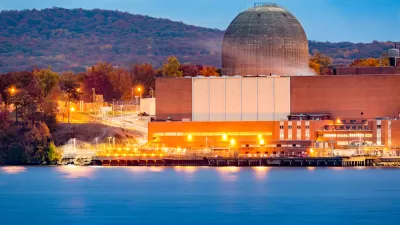
Google Inks Nuclear Power Deal
Tech giants are seeking out renewable energy to fuel power-hungry data centers and AI applications.

Google Seeks New Direction for Massive Housing Proposal
The company parted ways with its development partner, signaling a shift in strategy for a proposed 15,000-unit housing and office space project on Google-owned land in Silicon Valley.

Alabama: Trump Terminates Settlements for Black Communities Harmed By Raw Sewage
Trump deemed the landmark civil rights agreement “illegal DEI and environmental justice policy.”

Planetizen Federal Action Tracker
A weekly monitor of how Trump’s orders and actions are impacting planners and planning in America.

The 120 Year Old Tiny Home Villages That Sheltered San Francisco’s Earthquake Refugees
More than a century ago, San Francisco mobilized to house thousands of residents displaced by the 1906 earthquake. Could their strategy offer a model for the present?

Ken Jennings Launches Transit Web Series
The Jeopardy champ wants you to ride public transit.

BLM To Rescind Public Lands Rule
The change will downgrade conservation, once again putting federal land at risk for mining and other extractive uses.

Indy Neighborhood Group Builds Temporary Multi-Use Path
Community members, aided in part by funding from the city, repurposed a vehicle lane to create a protected bike and pedestrian path for the summer season.
Urban Design for Planners 1: Software Tools
This six-course series explores essential urban design concepts using open source software and equips planners with the tools they need to participate fully in the urban design process.
Planning for Universal Design
Learn the tools for implementing Universal Design in planning regulations.
Clanton & Associates, Inc.
Jessamine County Fiscal Court
Institute for Housing and Urban Development Studies (IHS)
City of Grandview
Harvard GSD Executive Education
Toledo-Lucas County Plan Commissions
Salt Lake City
NYU Wagner Graduate School of Public Service