


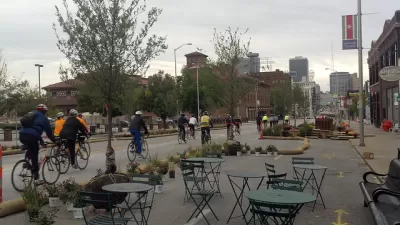
Kaid Benfield reports on the Chicago-based Center for Neighborhood Technology's robust, interactive Housing + Transportation Affordability Index, a fantastic resource for location-specific information, including housing and transportation costs.
While the index has been growing for many years, it now covers 89% of the population and provides the ability to demonstrate the place-based relationship between transportation and household costs on affordability, as well as a wealth of other data. It also sounds easy to use and fun to play with, according to Benfield's description
Benfield writes that, "CNT found that, between 2000 and 2009, US transportation and housing costs increased at nearly twice the rate of incomes. If you're feeling squeezed, no wonder. But the good news, the organization reports, is that people living in "location efficient" neighborhoods-those with good access to transit, jobs, and amenities-experienced only half the increase in transportation costs ($1,400/year) of those living in car-dependent places ($3,900/year)."
Benfield sees the Index's potential uses as diverse and plentiful. "The federal Department of Housing and Urban Development, for example, announced in 2010 that it would begin using location efficiency data...to assist its evaluation of grant applications...At the local government level, officials can use the data to assist zoning and investment practices to maximize the benefits for their residents."
FULL STORY: Nationwide data show how transportation costs hurt families, better planning can help

Center for Neighborhood Technology Responds to Criticism
Editor's Note: A recent Planetizen blog post by the University of South Florida’s Steven Polzin voiced several criticisms about the Housing + Transportation (H+T®) Affordability Index, created by the Chicago-based Center for Neighborhood Technology (CNT). We have provided a venue for Scott Bernstein, founder and president of CNT, to respond below. CNT’s H+T Index Fills Gaps in Data that Others Don’t Provide

Advocates Urge Mayor Lightfoot to Keep Transit Running in the Event of Post-Election Unrest
Nine organizations signed a petition to prioritize access to transit during potential post-election protests.
7 Grassroots Strategies Empowering Urban Communities
These grassroots strategies are helping urban neighborhoods improve the quality of life for many of their citizens.

Alabama: Trump Terminates Settlements for Black Communities Harmed By Raw Sewage
Trump deemed the landmark civil rights agreement “illegal DEI and environmental justice policy.”

Planetizen Federal Action Tracker
A weekly monitor of how Trump’s orders and actions are impacting planners and planning in America.

The 120 Year Old Tiny Home Villages That Sheltered San Francisco’s Earthquake Refugees
More than a century ago, San Francisco mobilized to house thousands of residents displaced by the 1906 earthquake. Could their strategy offer a model for the present?

Ken Jennings Launches Transit Web Series
The Jeopardy champ wants you to ride public transit.

BLM To Rescind Public Lands Rule
The change will downgrade conservation, once again putting federal land at risk for mining and other extractive uses.

Indy Neighborhood Group Builds Temporary Multi-Use Path
Community members, aided in part by funding from the city, repurposed a vehicle lane to create a protected bike and pedestrian path for the summer season.
Urban Design for Planners 1: Software Tools
This six-course series explores essential urban design concepts using open source software and equips planners with the tools they need to participate fully in the urban design process.
Planning for Universal Design
Learn the tools for implementing Universal Design in planning regulations.
Clanton & Associates, Inc.
Jessamine County Fiscal Court
Institute for Housing and Urban Development Studies (IHS)
City of Grandview
Harvard GSD Executive Education
Toledo-Lucas County Plan Commissions
Salt Lake City
NYU Wagner Graduate School of Public Service