


A new study that explores the geography of twitter networks finds that rather than making place obsolete, their intensity can be predicted by location and proximity, suggesting they enhance location based relationships.
The research, carried out by University of Toronto and Dalhousie University academics, focused on roughly 2,000 dyadic tweeters, which they located in 386 distinct locations, or "regional clusters."
Their results indicated that four in every ten pairs are located in the same regional cluster, and that those that were separated by distance were linked by a high frequency of airline connections between their respective locations. "Ties of less than 1,000 kilometers are more common than expected (if such ties were random) and ties of greater than 5,000 kilometers are much less so."
The research indicates that twitter networks tends to reinforce and strengthen real world networks, rather than replace them. Richard Florida suggests that "instead of freeing us from place, the Internet appears to enhance and even expand its role."
FULL STORY: How Twitter Proves That Place Matters

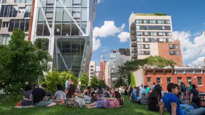
'The New Urban Crisis' and the High Line
A PBS NewsHour two-fer: an interview of urbanologist Richard Florida conducted in a walking tour of New York's famed High Line in the gentrifying West Chelsea neighborhood, a fitting backdrop for his new book, "The New Urban Crisis."
Florida, Florida, Florida
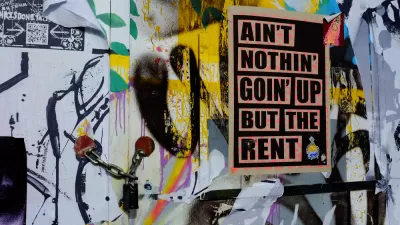
In his new book, Richard Florida worries about segregation and redefines "the creative class."
Florida Man Fails to Fix Everything, Reconsiders Position
Richard Florida was right about everything, except when he wasn't. Ben Brown brings us up to speed on the Creative Class.

Alabama: Trump Terminates Settlements for Black Communities Harmed By Raw Sewage
Trump deemed the landmark civil rights agreement “illegal DEI and environmental justice policy.”

Planetizen Federal Action Tracker
A weekly monitor of how Trump’s orders and actions are impacting planners and planning in America.

The 120 Year Old Tiny Home Villages That Sheltered San Francisco’s Earthquake Refugees
More than a century ago, San Francisco mobilized to house thousands of residents displaced by the 1906 earthquake. Could their strategy offer a model for the present?

Ken Jennings Launches Transit Web Series
The Jeopardy champ wants you to ride public transit.

BLM To Rescind Public Lands Rule
The change will downgrade conservation, once again putting federal land at risk for mining and other extractive uses.

Indy Neighborhood Group Builds Temporary Multi-Use Path
Community members, aided in part by funding from the city, repurposed a vehicle lane to create a protected bike and pedestrian path for the summer season.
Urban Design for Planners 1: Software Tools
This six-course series explores essential urban design concepts using open source software and equips planners with the tools they need to participate fully in the urban design process.
Planning for Universal Design
Learn the tools for implementing Universal Design in planning regulations.
Clanton & Associates, Inc.
Jessamine County Fiscal Court
Institute for Housing and Urban Development Studies (IHS)
City of Grandview
Harvard GSD Executive Education
Toledo-Lucas County Plan Commissions
Salt Lake City
NYU Wagner Graduate School of Public Service