


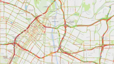
The U.S. Postal Service operates a massive fleet of trucks and vans throughout the country. Michael Ravnitzky argues that this fleet could be easily modified to collect data about the places the vehicles go.
He suggests the fleet could collect data on weather conditions and air pollutants throughout cities.
"After all, the delivery fleet already goes to almost every home and business in America nearly every day, and it travels fixed routes along a majority of the country's roads to get there. Data collection wouldn't require much additional staff or resources; all it would take would be a small, cheap and unobtrusive sensor package mounted on each truck. (This idea is mine alone, and does not necessarily reflect the views of the Postal Regulatory Commission.)
The key elements for the project already exist, including tiny, inexpensive G.P.S. receivers and radio uplinks, features found in today's smart phones. The sensors would operate without distracting the drivers from their primary responsibilities. The service could also minimize startup costs by teaming up with a company to develop, install and operate the equipment. One company under contract with the National Weather Service is already installing environmental sensors on long-haul commercial buses to enhance weather forecasting."
FULL STORY: The Postman Always Pings Twice

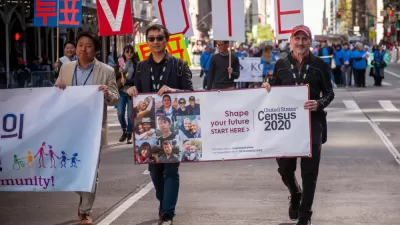
Debunking the Myth of the Declining White Population
Media claimed that Census data showed a sharp decline in America's white population, but the widely publicized figure reflects a misunderstanding of new data collection techniques.
Real-Time Art Installation Reveals the Many Dimensions of Data
Using a wagon filled with phones, an artist in Berlin demonstrated the disconnect between data and the real world.

4 Urban Analytics and Modeling Trends to Watch in 2020
Urban analytics has the potential to benefit both planners and the world. Here' are a few ways that new data-based approaches can open new levels of analysis and understanding.

Alabama: Trump Terminates Settlements for Black Communities Harmed By Raw Sewage
Trump deemed the landmark civil rights agreement “illegal DEI and environmental justice policy.”

Planetizen Federal Action Tracker
A weekly monitor of how Trump’s orders and actions are impacting planners and planning in America.

The 120 Year Old Tiny Home Villages That Sheltered San Francisco’s Earthquake Refugees
More than a century ago, San Francisco mobilized to house thousands of residents displaced by the 1906 earthquake. Could their strategy offer a model for the present?

Ken Jennings Launches Transit Web Series
The Jeopardy champ wants you to ride public transit.

BLM To Rescind Public Lands Rule
The change will downgrade conservation, once again putting federal land at risk for mining and other extractive uses.

Indy Neighborhood Group Builds Temporary Multi-Use Path
Community members, aided in part by funding from the city, repurposed a vehicle lane to create a protected bike and pedestrian path for the summer season.
Urban Design for Planners 1: Software Tools
This six-course series explores essential urban design concepts using open source software and equips planners with the tools they need to participate fully in the urban design process.
Planning for Universal Design
Learn the tools for implementing Universal Design in planning regulations.
Clanton & Associates, Inc.
Jessamine County Fiscal Court
Institute for Housing and Urban Development Studies (IHS)
City of Grandview
Harvard GSD Executive Education
Toledo-Lucas County Plan Commissions
Salt Lake City
NYU Wagner Graduate School of Public Service