


Grist digs deeper into the Virginia Speed Hump murder - showing how the street configuration of the suburban neighborhood may have contributed to the rage, and why it's unlikely to see more neighborhoods like it in the future.
See Planetizen: Virginia Speed Bump Leads to Neighborhood Activist's Murder.
Was the homicide an extension of road-rage caused by the installation of the speed hump? Grist transportation reporter Sarah Goodyear notes that if the neighborhood was constructed in more of a grid layout, there would not have been a need for the traffic calming sought by the victim.
"A Google map view of Field Master Drive, where Carr (the victim) lived, shows a typical suburban pattern of cul-de-sacs and quiet residential streets, with a couple of major roads slicing through. Field Master Drive looks like a main route between two of those larger arterials...
It's a development style that has been shown to increase congestion on the main roads and speeding on the few side streets that provide some connection, rather than leading to a dead end. Streets like Field Master Drive.
Just last year, the state of Virginia announced it would not maintain streets in new subdivisions unless they were laid out with a design that links homes, stores, schools, and other destinations. The aim is to encourage a different style of development, one that would have fewer traffic jams, better access for emergency vehicles, and more walkable neighborhoods."
Thanks to Daily Grist
FULL STORY: Virginia man is murdered after dispute over traffic calming

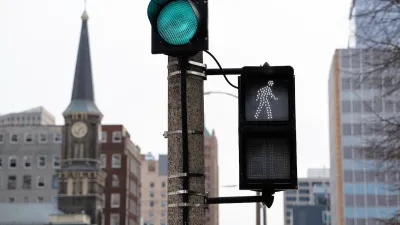
Milwaukee Announces 60 Traffic Calming Projects for 2025
The city has successfully reduced traffic deaths and aims to eliminate them completely within the next decade.
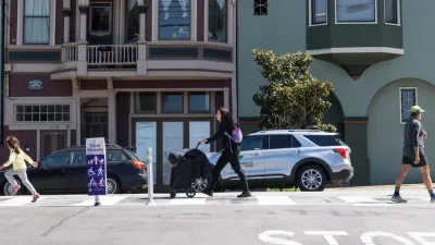
San Francisco Slow Streets Bucks Citywide Trend, Reducing Injuries by 61 Percent
Low-cost interventions aimed at slowing traffic are making a major impact on road safety.
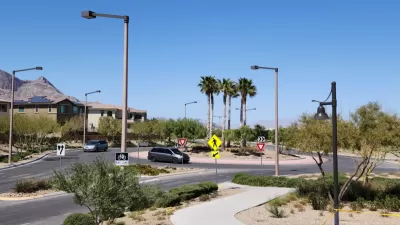
Las Vegas Uses ‘Mini-Roundabout’ for Traffic Calming
Roundabouts, commonly used in other countries, are starting to catch on in U.S. cities. They can improve traffic flow and bring efficiency benefits.

Alabama: Trump Terminates Settlements for Black Communities Harmed By Raw Sewage
Trump deemed the landmark civil rights agreement “illegal DEI and environmental justice policy.”

Planetizen Federal Action Tracker
A weekly monitor of how Trump’s orders and actions are impacting planners and planning in America.

The 120 Year Old Tiny Home Villages That Sheltered San Francisco’s Earthquake Refugees
More than a century ago, San Francisco mobilized to house thousands of residents displaced by the 1906 earthquake. Could their strategy offer a model for the present?

Ken Jennings Launches Transit Web Series
The Jeopardy champ wants you to ride public transit.

BLM To Rescind Public Lands Rule
The change will downgrade conservation, once again putting federal land at risk for mining and other extractive uses.

Indy Neighborhood Group Builds Temporary Multi-Use Path
Community members, aided in part by funding from the city, repurposed a vehicle lane to create a protected bike and pedestrian path for the summer season.
Urban Design for Planners 1: Software Tools
This six-course series explores essential urban design concepts using open source software and equips planners with the tools they need to participate fully in the urban design process.
Planning for Universal Design
Learn the tools for implementing Universal Design in planning regulations.
Clanton & Associates, Inc.
Jessamine County Fiscal Court
Institute for Housing and Urban Development Studies (IHS)
City of Grandview
Harvard GSD Executive Education
Toledo-Lucas County Plan Commissions
Salt Lake City
NYU Wagner Graduate School of Public Service