


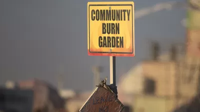
The annual week-long art festival Burning Man is kind of hard to define. This infographic provides some data and context about the event and the temporary city it forms in the Nevada desert every year.
SPUR Urbanist points to the work of Flint Hahn, who sifted through the data to create this infographic of the temporary city in the desert.
"Over the course of two weeks, from conceptualization to final graphic design, Flint Hahn, a six-year veteran of the event, put together this infographic. He gathered the data needed from post-event after reports on the Burning Man web site, contacting various departments in the organization, the Nevada Bureau of Land Management, NASA historical astronomy data, online population sources, Flickr, Wikipedia, among a variety of other sources. Regardless of the amount of data collected, Flint was well aware that displaying the true essence of Burning Man through data could never be achieved. Flint stated, 'This is an event based on personal experiences. I could produce many interesting statistical trends, eye-catching illustrations, and visual charts, but it would never capture what the event is. It's a common question with unlimited answers, 'What is Burning Man?' If anything, this infographic may be the antithesis of what Burning Man is.' As we at SPUR found out this past spring when we hosted Burning Man's founder, Larry Harvey, some questions are better left unanswered."
FULL STORY: Datablog: Creating framework without a frame - the Burning Man infographic

There Goes the Neighborhood: Oh No, Not Burning Man!
Ben Brown unpacks the components of polarization. Recognizing some people are really pissed off for some really good reasons doesn’t seem to help us make better decisions, whether we’re talking about electing a president or planning a park.
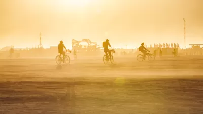
Designing the Black Rock City of Burning Man's Dreams
An unofficial, international competition for the Black Rock City master plan applies the imagination inherent to its setting.

Burning Man Buys 3,800 Acres in Northwest Nevada
Let the year-round party commence.

Alabama: Trump Terminates Settlements for Black Communities Harmed By Raw Sewage
Trump deemed the landmark civil rights agreement “illegal DEI and environmental justice policy.”

Planetizen Federal Action Tracker
A weekly monitor of how Trump’s orders and actions are impacting planners and planning in America.

The 120 Year Old Tiny Home Villages That Sheltered San Francisco’s Earthquake Refugees
More than a century ago, San Francisco mobilized to house thousands of residents displaced by the 1906 earthquake. Could their strategy offer a model for the present?

In Both Crashes and Crime, Public Transportation is Far Safer than Driving
Contrary to popular assumptions, public transportation has far lower crash and crime rates than automobile travel. For safer communities, improve and encourage transit travel.

Report: Zoning Reforms Should Complement Nashville’s Ambitious Transit Plan
Without reform, restrictive zoning codes will limit the impact of the city’s planned transit expansion and could exclude some of the residents who depend on transit the most.

Judge Orders Release of Frozen IRA, IIJA Funding
The decision is a victory for environmental groups who charged that freezing funds for critical infrastructure and disaster response programs caused “real and irreparable harm” to communities.
Urban Design for Planners 1: Software Tools
This six-course series explores essential urban design concepts using open source software and equips planners with the tools they need to participate fully in the urban design process.
Planning for Universal Design
Learn the tools for implementing Universal Design in planning regulations.
Clanton & Associates, Inc.
Jessamine County Fiscal Court
Institute for Housing and Urban Development Studies (IHS)
City of Grandview
Harvard GSD Executive Education
Toledo-Lucas County Plan Commissions
Salt Lake City
NYU Wagner Graduate School of Public Service