


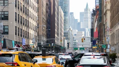
Through a survey of New York City taxis with GPS tracking devices, the city has created a database of speeds and routes that gives them a clear picture of the state of traffic in the city.
"Traffic in Manhattan has a rhythm all its own, and, according to a new study by the city, it is not quite the constant gridlock that it seems.
Using data from the GPS devices in all New York City cabs, officials tracked the routes of tens of millions of taxi trips over the past two years. The result: a database of speeds and travel routes that can be broken down by minute, month and neighborhood.
'It's like an M.R.I.,' said Bruce Schaller, a deputy transportation commissioner who supervised the city's study."
The data offers officials a look at where traffic problems have been occurring, and when they're likely to occur. Transportation officials are already using the data to tweak traffic along one of the city main arteries, according to this piece from The New York Times.
FULL STORY: Gridlock May Not Be Constant, but Slow Going Is Here to Stay

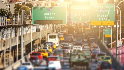
Agreement Keeps NYC Congestion Pricing Alive Through Summer
The tolling program will continue while a court considers the city’s lawsuit against the Trump administration.
Multiple Lawsuits Aim to Save NYC Congestion Pricing
Environmental and transit advocacy groups, along with the MTA, are suing USDOT over its recent crusade to end the cordon pricing program.
Is Trump’s Reversal of Congestion Pricing Legal?
Gov. Hochul says New York City will “keep its cameras on.” Can the administration legally end the nation's first cordon pricing program?

Alabama: Trump Terminates Settlements for Black Communities Harmed By Raw Sewage
Trump deemed the landmark civil rights agreement “illegal DEI and environmental justice policy.”

Planetizen Federal Action Tracker
A weekly monitor of how Trump’s orders and actions are impacting planners and planning in America.

The 120 Year Old Tiny Home Villages That Sheltered San Francisco’s Earthquake Refugees
More than a century ago, San Francisco mobilized to house thousands of residents displaced by the 1906 earthquake. Could their strategy offer a model for the present?

In Both Crashes and Crime, Public Transportation is Far Safer than Driving
Contrary to popular assumptions, public transportation has far lower crash and crime rates than automobile travel. For safer communities, improve and encourage transit travel.

Report: Zoning Reforms Should Complement Nashville’s Ambitious Transit Plan
Without reform, restrictive zoning codes will limit the impact of the city’s planned transit expansion and could exclude some of the residents who depend on transit the most.

Judge Orders Release of Frozen IRA, IIJA Funding
The decision is a victory for environmental groups who charged that freezing funds for critical infrastructure and disaster response programs caused “real and irreparable harm” to communities.
Urban Design for Planners 1: Software Tools
This six-course series explores essential urban design concepts using open source software and equips planners with the tools they need to participate fully in the urban design process.
Planning for Universal Design
Learn the tools for implementing Universal Design in planning regulations.
Clanton & Associates, Inc.
Jessamine County Fiscal Court
Institute for Housing and Urban Development Studies (IHS)
City of Grandview
Harvard GSD Executive Education
Toledo-Lucas County Plan Commissions
Salt Lake City
NYU Wagner Graduate School of Public Service