


Some time ago I noted a number of terrific image resources for urban planners. This blog highlights some additional sources.

Some time ago I noted a number of terrific image resources
for urban planners.
This blog highlights some additional sources.
First of all, last year some of the undergraduate students in my class on Global Cities collaborated in
finding sources for images on that subject. The links to web sites are online
but a bit buried under "Student Links" halfway down this page.
The students found sites of well known organizations such as National
Geographic and the World Bank (for photos, not just charts),
and others you may not have heard of like Saudi
Aramco World.
Also worth a look is Visualizing Economics, a site with thought-provoking graphs and charts. The "most popular" links on
the right side navigation bar are typically worth a look. Charts are also classsifed by topic-for
instance resources about the very wealthy.
In a similar vein with a focus on international development,
health, and globalization, Gapminder shows what it
is possible for Swedish statisticans to to do with flash animations and time on their hands on long cold nights. You can see founder, Hans Rosling, in action on video and then
try it yourself with online and downloadable animations. His most famous video
is at now a few years old. You might want to check out what he said at the U.S State Department in Washington DC
last year.
YouTube is coming to be
better source for planning information so if you don't want to burn fossil fuels
to see some important planning places you can visit virtually. Type "Kibera," the
name of one of the largest squatter settlements in Africa
and toward the top is a compelling video, "The Women of Kibera," produced by
Amnesty International. Type "Poundbury," the name of a mixed-income development
sponsored by Britain's
Prince Charles, and several quite well-produced
videos appear. I've had much more luck searching YouTubewith specific personal and place names
than merely putting in more general terms like city or planning.
Finally, in terms of my previous list of image resources, while all the entries contain really interesting items, I do find myself returning to the blog Strange Maps, a site that can be relied on to provoke.


40 Visualizations of America and its Relationship with Food
A new post by Vox includes 40 maps, charts, and graphs explain that where and how food works in America.

Ken Jennings Launches Transit Web Series
The Jeopardy champ wants you to ride public transit.
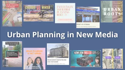
Urban Planning Creators You Should Know in 2024
Whether you’re a TikTok enthusiast or a Substack reader, you can find plenty of valuable and engaging urban planning content in the new media landscape.

Alabama: Trump Terminates Settlements for Black Communities Harmed By Raw Sewage
Trump deemed the landmark civil rights agreement “illegal DEI and environmental justice policy.”

Planetizen Federal Action Tracker
A weekly monitor of how Trump’s orders and actions are impacting planners and planning in America.

The 120 Year Old Tiny Home Villages That Sheltered San Francisco’s Earthquake Refugees
More than a century ago, San Francisco mobilized to house thousands of residents displaced by the 1906 earthquake. Could their strategy offer a model for the present?

Housing Vouchers as a Key Piece of Houston’s Housing Strategy
The Houston Housing Authority supports 19,000 households through the housing voucher program.

Rural Population Grew Again in 2024
Americans continued to move to smaller towns and cities, resulting in a fourth straight year of growth in rural areas.

Safe Streets Grants: What to Know
This year’s round of Safe Streets for All grant criteria come with some changes.
Urban Design for Planners 1: Software Tools
This six-course series explores essential urban design concepts using open source software and equips planners with the tools they need to participate fully in the urban design process.
Planning for Universal Design
Learn the tools for implementing Universal Design in planning regulations.
Clanton & Associates, Inc.
Jessamine County Fiscal Court
Institute for Housing and Urban Development Studies (IHS)
City of Grandview
Harvard GSD Executive Education
Toledo-Lucas County Plan Commissions
Salt Lake City
NYU Wagner Graduate School of Public Service