


Experts from heritage group Historic Scotland have developed a technique using lasers to create precise digital representations of enormous sites. Mount Rushmore is the next location to be captured.
Once captured, the team can simulate how the site looked in the past, or project forward.
"They can simulate the effects of climate change, urban encroachment or other natural or man-made disasters on those same sites, peering into the future.
Given a proposal for a new building in a city like Edinburgh, they can also create virtual realities, almost microscopically accurate, so viewers might see what the building looks like from all angles in the place where it's intended to go, including the shadows it might cast at different times of day."
FULL STORY: Scots Aim Lasers at Landmarks


A Different Approach to Public Engagement: Use Tech to Put Residents in Planners’ Shoes
Simulators can be a useful tool to help residents think differently about challenges like housing
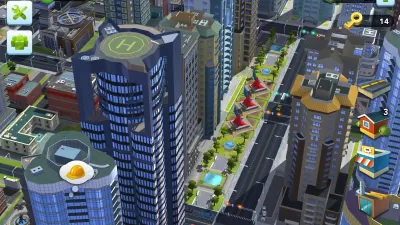
Simulating the City
Computer simulations show signs of a coming revolution with wide ranging impacts on many human endeavors, particularly cities and city planning.
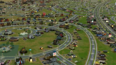
Visualizing Big Data In Your Own SimCity World
Two former Mozilla engineers strive to merge big data with a 3D model of London and, potentially, other cities.

Alabama: Trump Terminates Settlements for Black Communities Harmed By Raw Sewage
Trump deemed the landmark civil rights agreement “illegal DEI and environmental justice policy.”

Planetizen Federal Action Tracker
A weekly monitor of how Trump’s orders and actions are impacting planners and planning in America.

The 120 Year Old Tiny Home Villages That Sheltered San Francisco’s Earthquake Refugees
More than a century ago, San Francisco mobilized to house thousands of residents displaced by the 1906 earthquake. Could their strategy offer a model for the present?

Indy Neighborhood Group Builds Temporary Multi-Use Path
Community members, aided in part by funding from the city, repurposed a vehicle lane to create a protected bike and pedestrian path for the summer season.

Congestion Pricing Drops Holland Tunnel Delays by 65 Percent
New York City’s contentious tolling program has yielded improved traffic and roughly $100 million in revenue for the MTA.

In Both Crashes and Crime, Public Transportation is Far Safer than Driving
Contrary to popular assumptions, public transportation has far lower crash and crime rates than automobile travel. For safer communities, improve and encourage transit travel.
Urban Design for Planners 1: Software Tools
This six-course series explores essential urban design concepts using open source software and equips planners with the tools they need to participate fully in the urban design process.
Planning for Universal Design
Learn the tools for implementing Universal Design in planning regulations.
Clanton & Associates, Inc.
Jessamine County Fiscal Court
Institute for Housing and Urban Development Studies (IHS)
City of Grandview
Harvard GSD Executive Education
Toledo-Lucas County Plan Commissions
Salt Lake City
NYU Wagner Graduate School of Public Service