


Some call it a city of neighborhoods. This piece from the San Francisco Chronicle looks at the history of the urban form of San Francisco and why it looks the way it does today.
By official count there are either 40 or 48 neighborhoods in San Francisco, depending on who you ask. Unofficially, there are many more, and there always have been.
"The pioneers always had big plans for San Francisco - but it turned out to be a city of neighborhoods built around a downtown core. There were four reasons for this: geography, changing housing patterns, transit lines and disasters like the 1906 earthquake and fire.
San Francisco was laid out in a grid pattern imposed on a city of hills built on the end of a peninsula. This meant the city had a small area, but the grid pattern of the streets and the hills meant portions of the city were divided from each other, in separate little valleys."
FULL STORY: Growth of city neighborhoods

Airbnb Draws Tourists Off the Beaten Path
Airbnb connects travelers from around the world to unique rentable spaces. With the recent launch of a "Neighborhoods" feature, Airbnb has the potential to redirect tourist spending to often overlooked areas.
Burning Man Does Good At Home
Burning Man -- the annual arts festival and self-reliance experiment -- is more than a party in the desert. Its organizers are starting a new effort to revitalize the neighborhood around their San Francisco office.
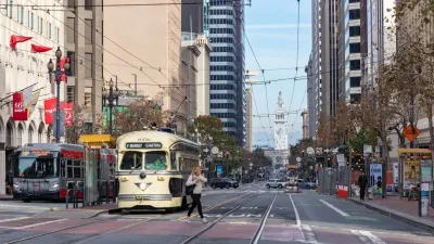
Waymo Gets Permission to Map SF’s Market Street
If allowed to operate on the traffic-restricted street, Waymo’s autonomous taxis would have a leg up over ride-hailing competitors — and counter the city’s efforts to grow bike and pedestrian on the thoroughfare.

Alabama: Trump Terminates Settlements for Black Communities Harmed By Raw Sewage
Trump deemed the landmark civil rights agreement “illegal DEI and environmental justice policy.”

Planetizen Federal Action Tracker
A weekly monitor of how Trump’s orders and actions are impacting planners and planning in America.

The 120 Year Old Tiny Home Villages That Sheltered San Francisco’s Earthquake Refugees
More than a century ago, San Francisco mobilized to house thousands of residents displaced by the 1906 earthquake. Could their strategy offer a model for the present?

Ken Jennings Launches Transit Web Series
The Jeopardy champ wants you to ride public transit.

BLM To Rescind Public Lands Rule
The change will downgrade conservation, once again putting federal land at risk for mining and other extractive uses.

Indy Neighborhood Group Builds Temporary Multi-Use Path
Community members, aided in part by funding from the city, repurposed a vehicle lane to create a protected bike and pedestrian path for the summer season.
Urban Design for Planners 1: Software Tools
This six-course series explores essential urban design concepts using open source software and equips planners with the tools they need to participate fully in the urban design process.
Planning for Universal Design
Learn the tools for implementing Universal Design in planning regulations.
Clanton & Associates, Inc.
Jessamine County Fiscal Court
Institute for Housing and Urban Development Studies (IHS)
City of Grandview
Harvard GSD Executive Education
Toledo-Lucas County Plan Commissions
Salt Lake City
NYU Wagner Graduate School of Public Service