


New maps created by the Center for Neighborhood Technology show that while emissions are greater per acre in cities, they are greater per household in suburbs.
"Transportation accounts for 28 percent of all US greenhouse gases, according to CNT, and I believe it accounts for an even higher portion of carbon dioxide emissions specifically. According to CNT president Scott Bernstein:
"Cities are more location-efficient - meaning key destinations are closer to where people live and work They require less time, money, fuel and greenhouse gas emissions for residents to meet their everyday travel needs. People can walk, bike, car-share, take public transit. So residents of cities and compact communities generate less CO2 per household than people who live in more dispersed communities, like many suburbs and outlying areas.
"If you're deciding where to live, consider moving to an urban area. You'll help fight global warming by emitting less CO2. And you're likely to drive less, so you'll spend less on transportation, saving up to $5,000 annually.""
FULL STORY: Dramatic new maps of CO2 emissions per household

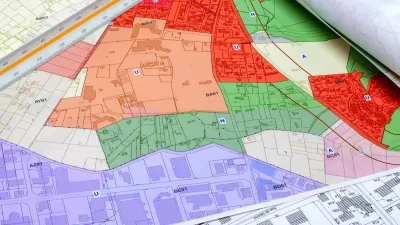
How Zoning Affects Greenhouse Gas Emissions
As the urgency of the climate crisis increases, a paper in the Notre Dame Law Review argues that increased density is not a universally effective strategy to reduce emissions and that different strategies are needed for low-carbon places versus high-carbon ones.

Snowstorm That Stranded Thousands Prompts Questions About Auto-Centric Development
After thousands of motorists spent over a day on a snowbound Virginia highway, experts are warning that auto-centric sprawl will worsen the impacts of extreme weather events.

Largest Carbon Capture Plant in the World Opens in Iceland
The plant draws carbon from the atmosphere and turns it to stone in underground wells, but the technology remains relatively expensive.

Alabama: Trump Terminates Settlements for Black Communities Harmed By Raw Sewage
Trump deemed the landmark civil rights agreement “illegal DEI and environmental justice policy.”

Planetizen Federal Action Tracker
A weekly monitor of how Trump’s orders and actions are impacting planners and planning in America.

The 120 Year Old Tiny Home Villages That Sheltered San Francisco’s Earthquake Refugees
More than a century ago, San Francisco mobilized to house thousands of residents displaced by the 1906 earthquake. Could their strategy offer a model for the present?

Ken Jennings Launches Transit Web Series
The Jeopardy champ wants you to ride public transit.

BLM To Rescind Public Lands Rule
The change will downgrade conservation, once again putting federal land at risk for mining and other extractive uses.

Indy Neighborhood Group Builds Temporary Multi-Use Path
Community members, aided in part by funding from the city, repurposed a vehicle lane to create a protected bike and pedestrian path for the summer season.
Urban Design for Planners 1: Software Tools
This six-course series explores essential urban design concepts using open source software and equips planners with the tools they need to participate fully in the urban design process.
Planning for Universal Design
Learn the tools for implementing Universal Design in planning regulations.
Clanton & Associates, Inc.
Jessamine County Fiscal Court
Institute for Housing and Urban Development Studies (IHS)
City of Grandview
Harvard GSD Executive Education
Toledo-Lucas County Plan Commissions
Salt Lake City
NYU Wagner Graduate School of Public Service