


By mapping rat infestations, New York City's health inspectors have found a whole new way to beat back the rodents.
"Michael Mills, a veteran health inspector in New York City, helps create a map of the city you won't find in any guidebook: a rat map.
The city's rat map was first introduced a year ago, with an intensive pilot program in the Bronx. Mills and other inspectors scoured the streets, building by building, cataloging rat hotspots - places that show so-called active rat signs, such as lived-in burrows, fresh droppings, tell-tale gnaw marks on plastic garbage bags - in an effort to target rodent-control measures more effectively. That geocoding information was entered into each inspector's hand-held indexing computer and aggregated with similar data from all across the borough.
Today, rodent complaints by residents from all over New York are electronically pinpointed on the city's computerized rat map, which allows inspectors to track complaints and hotspots over time and determine how well rat-control efforts are working. The results, after just one year, should be music to the ears of most New Yorkers: When the pilot study began in the Bronx, inspectors found active rat signs on 3,100 of the borough's 39,000 properties. Preliminary results now show that 1,250 of those properties are rat-free. That's a 40% dropoff in infestations."
FULL STORY: Mapping the Rats in New York City

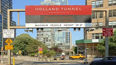
Congestion Pricing Drops Holland Tunnel Delays by 65 Percent
New York City’s contentious tolling program has yielded improved traffic and roughly $100 million in revenue for the MTA.

A Visual Celebration of Manhattan’s Chinatown Elder Community, Through Food
Lanterns, cafeteria trays, and community connection take center stage in this stunning photo essay.
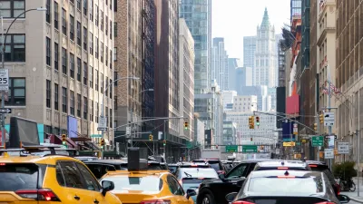
Agreement Keeps NYC Congestion Pricing Alive Through Summer
The tolling program will continue while a court considers the city’s lawsuit against the Trump administration.

Alabama: Trump Terminates Settlements for Black Communities Harmed By Raw Sewage
Trump deemed the landmark civil rights agreement “illegal DEI and environmental justice policy.”

Planetizen Federal Action Tracker
A weekly monitor of how Trump’s orders and actions are impacting planners and planning in America.

The 120 Year Old Tiny Home Villages That Sheltered San Francisco’s Earthquake Refugees
More than a century ago, San Francisco mobilized to house thousands of residents displaced by the 1906 earthquake. Could their strategy offer a model for the present?

Ken Jennings Launches Transit Web Series
The Jeopardy champ wants you to ride public transit.

BLM To Rescind Public Lands Rule
The change will downgrade conservation, once again putting federal land at risk for mining and other extractive uses.

Indy Neighborhood Group Builds Temporary Multi-Use Path
Community members, aided in part by funding from the city, repurposed a vehicle lane to create a protected bike and pedestrian path for the summer season.
Urban Design for Planners 1: Software Tools
This six-course series explores essential urban design concepts using open source software and equips planners with the tools they need to participate fully in the urban design process.
Planning for Universal Design
Learn the tools for implementing Universal Design in planning regulations.
Clanton & Associates, Inc.
Jessamine County Fiscal Court
Institute for Housing and Urban Development Studies (IHS)
City of Grandview
Harvard GSD Executive Education
Toledo-Lucas County Plan Commissions
Salt Lake City
NYU Wagner Graduate School of Public Service