


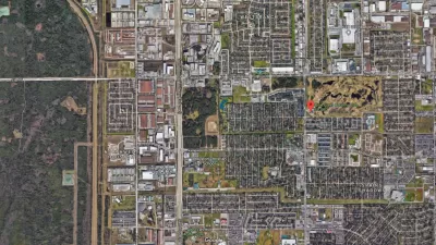
New modeling software could soon be available that would allow monitoring across the internet of flood levels in specific areas- like your backyard.
"The images are all too familiar: overtopped levees, homes submerged in floodwaters, rescuers motoring down city streets in fishing boats. This summer, before the muck had even been cleared from neighborhoods in the heart of the Midwest, the question resurfaced: What happened? Three years after Hurricane Katrina, and 15 years after disastrous flooding throughout the Midwest, how could the country allow rising waters to kill at least 24 people and cause billions in damage to structures and crops? And the Mississippi Basin isn't the only region at risk. Aging flood walls protect areas from California's Sacramento–San Joaquin River Delta to the shores of Florida's Lake Okeechobee, threatening future devastation. For many, the answer seems clear. Raise levees high enough to ensure that no flood ever wreaks havoc again.
Unfortunately, it's not so simple. For one thing, it's unclear just how high levees should be built. "In Cedar Rapids [Iowa], nobody would have dreamed the river could get that high," says Jeffrey Schott, an instructor of urban and regional planning at the University of Iowa in Iowa City, where 21 buildings were flooded. The flood walls in Cedar Rapids, which had been built to a so-called 100-year standard, were overwhelmed by water that rose to a 500-year level. (The language is misleading: The next "500-year flood" could come next spring.)
'After '93, we could have built the levees in the Midwest 10 ft. higher, for example,' says Robert Holmes, national flood specialist for the United States Geological Survey. 'But the cost far exceeds the benefit.'"
FULL STORY: Thinking Beyond Levees, Experts Turn to New Flood Software

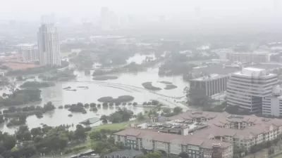
800 New Homes Approved for Houston's Floodplain
The city of Houston approved a new development that doesn't meet new elevations standards approved by the city of Houston earlier this month.
Houston Seriously Tightens Rules on Floodplain Construction
It was the city's "first major regulatory response" to Hurricane Harvey.
Flood Control Project On Death Bed
An Army Corps of Engineers flood control project in south-central Mississippi is in danger of being vetoed by the U.S. Environmental Protection Agency. But supporters have not given up hope.

Alabama: Trump Terminates Settlements for Black Communities Harmed By Raw Sewage
Trump deemed the landmark civil rights agreement “illegal DEI and environmental justice policy.”

Planetizen Federal Action Tracker
A weekly monitor of how Trump’s orders and actions are impacting planners and planning in America.

The 120 Year Old Tiny Home Villages That Sheltered San Francisco’s Earthquake Refugees
More than a century ago, San Francisco mobilized to house thousands of residents displaced by the 1906 earthquake. Could their strategy offer a model for the present?

Indy Neighborhood Group Builds Temporary Multi-Use Path
Community members, aided in part by funding from the city, repurposed a vehicle lane to create a protected bike and pedestrian path for the summer season.

Congestion Pricing Drops Holland Tunnel Delays by 65 Percent
New York City’s contentious tolling program has yielded improved traffic and roughly $100 million in revenue for the MTA.

In Both Crashes and Crime, Public Transportation is Far Safer than Driving
Contrary to popular assumptions, public transportation has far lower crash and crime rates than automobile travel. For safer communities, improve and encourage transit travel.
Urban Design for Planners 1: Software Tools
This six-course series explores essential urban design concepts using open source software and equips planners with the tools they need to participate fully in the urban design process.
Planning for Universal Design
Learn the tools for implementing Universal Design in planning regulations.
Clanton & Associates, Inc.
Jessamine County Fiscal Court
Institute for Housing and Urban Development Studies (IHS)
City of Grandview
Harvard GSD Executive Education
Toledo-Lucas County Plan Commissions
Salt Lake City
NYU Wagner Graduate School of Public Service