


One citizen planner's journey across the United States provides a glimpse at how stronger connections between people and places can create better communities.
 Between Memorial Day weekend and July 10th I traveled across the United States on U.S. Highway 50. During my six plus weeks on the road -- from Ocean City, Maryland, to West Sacramento, California -- I met with over one hundred planners, planning commissioners, local officials, and citizen activists.
While I've posted many reports about my travels on a web blog I maintained -- www.rte50.com -- I thought that Planetizen readers might be especially interested in one of the topics that repeatedly came up: the importance of connecting neighborhoods, and people, in our cities and towns.
Since my return to Burlington, Vermont, I've spent time working on our city's new transportation plan -- I'm a member of the advisory committee providing input on the plan. One of the points we've been discussing is how to build more "connectivity" into Burlington. In part, that means enabling residents to more easily walk or bicycle between neighborhoods.
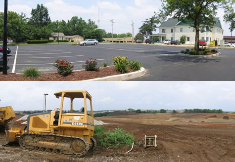
That's an idea I heard mentioned by many planners and planning commissioners in communities I visited during June and July. At its most basic, as in Montrose, Colorado, it means retrofitting already developed residential enclaves so that there are sidewalk and road connections. One problem that Kerwin Jensen, Montrose's planning director, described to me is the difficulty people have in getting around by bike or on foot without being forced to use heavily traveled county roads. (For more details, see my report from Montrose)
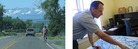
But also in Colorado -- and elsewhere -- I found planners proactively ensuring that connectivity is in place as developments are being built. In Fruita, Colorado, planners Dahna Raugh & Chris Brubaker showed me how new residential subdivisions are being linked in to the city's growing trail system.
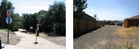
A couple of days later, in Moab, Utah, community development director David Olsen stressed his small city's commitment to connecting all of the city's neighborhoods by a trail system. He showed me parts of the Mill Creek Parkway trail, noting that it already connects three of the city's four K-12 schools.
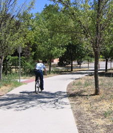
While planners and planning commissioners still confront residents who feel that building trails and connecting subdivisions only serves to make it easier for criminals to get access to their neighborhood, this is an argument without evidence. In fact, a growing body of research shows that having a nearby trail or recreational path is an amenity that, if anything, increases property values.
Indeed, recreational trails are one key element in something else I also regularly heard about during my travels: "quality of life."
But let me to get back to connections, because what I want to mention goes beyond just the physical connections that trail networks represent. What struck me during my Route 50 trip was the interest in strengthening connections between people. This came up, for example, in the importance (expressed to me in several communities) of retaining a "small town" character.
I wrote about this in one of my posts from O'Fallon, Illinois. Interestingly, O'Fallon is a booming suburb. Yet planning Director Ted Shekell, Mayor Gary Graham, and others I met with all told me they wanted O'Fallon to hold onto its small town feel. For planning commission Chair Gene McCoskey, that means a place where "kids have a neighborhood," and where you can count on your schools and churches for providing a supportive network, and, as Gene put it, "a sense of accountability." And as Mayor Graham interestingly added, it also means having elected and appointed officials who are readily accessible, "who listen and who are responsive."
But what can planners do to support the kind of connections between people I just described? One idea is promoting mixed-use places where there are simply more opportunities for people to run into each other and connect. This, I believe, is at least part of what's behind the interest many suburban areas have in developing new downtowns and town centers.
In Creve Coeur, Missouri, a St. Louis suburb, planners are focusing on developing a downtown for their suburban city. Why do this? I asked planning commissioner Gene Rovak. One reason, Gene replied, "is to give us a sense of identity." As Gene's fellow planning commissioner Carl Moskowitz added, "our new downtown will also be a walking district ... with [higher density] housing as part of it, empty nesters will have the chance to sell their homes but stay in Creve Coeur."
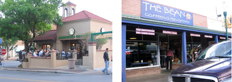
Another way of supporting connections is through "third places" -- that is, neighborhood groceries, coffee shops, restaurants, and other gathering spots.
Farmers markets also seem a part of this. One of the attractions -- besides the fresh food -- is the opportunity to see friends and neighbors and catch up on what's going on. In fact, Richard McCarthy, President of the Farmers Market Coalition mentioned this to me when I interviewed him. (Full interview).

During my travels I was certainly struck by the proliferation of coffee houses.
Perhaps we should thank Starbucks for helping generate this -- or maybe they've just been smart in identifying something people have been thirsting for. But even in small cities and towns, the local coffee house or java cafe was a place where I almost invariably found large numbers of people (especially young people) sitting down & chatting away. Many were Starbucks, but even more were lively, locally owned places.
For planners, the question is not so much what we're doing to encourage this trend, but are we doing things that impede it.
Do our zoning codes prevent these kind of third places in our neighborhoods? That's a difficult issue in many places where residents are concerned about opening the door -- even just a crack -- to commercial activity in the midst of residential neighborhoods. Do we have burdensome parking requirements that make these small-scale uses difficult downtown (especially given how much parking is often already available)?
One last thought. There was one other type of connection that impressed me during my travels. That was how well connected planners and planning commissioners seemed to be in terms of knowing their communities. In fact, that's an essential part of being an effective planner or planning board member.
It's something that Elaine Cogan in her columns for the Planning Commissioners Journal has often stressed: to be effective, you need to have the pulse of the community -- whether it's what's going on in neighborhoods, what's on the mind of your Mayor or City Council, or what's the viewpoint of the business community or local developers. Yes, planners love to (and need to) work with census information, maps, and all sorts of data, but it's staying connected with people that's the real key to effective local planning.
Wayne Senville is Publisher & Editor of the Planning Commissioners Journal, a national quarterly received by more than 7,500 citizen and professional planners. His more than 100 posts from his trip along Route 50 this Summer are available at www.rte50.com.


What ‘The Brutalist’ Teaches Us About Modern Cities
How architecture and urban landscapes reflect the trauma and dysfunction of the post-war experience.

‘Complete Streets’ Webpage Deleted in Federal Purge
Basic resources and information on building bike lanes and sidewalks, formerly housed on the government’s Complete Streets website, are now gone.

The VW Bus is Back — Now as an Electric Minivan
Volkswagen’s ID. Buzz reimagines its iconic Bus as a fully electric minivan, blending retro design with modern technology, a 231-mile range, and practical versatility to offer a stylish yet functional EV for the future.

Electric Vehicles for All? Study Finds Disparities in Access and Incentives
A new UCLA study finds that while California has made progress in electric vehicle adoption, disadvantaged communities remain underserved in EV incentives, ownership, and charging access, requiring targeted policy changes to advance equity.

SoCal Leaders Debate Moving Coastal Rail Line
Train tracks running along the Pacific Ocean are in danger from sea level rise, but residents are divided on how to fix the problem.

Are Mobility Hubs Child-Friendly?
‘Mobility hubs’ aim to make urban travel easier by connecting travel modes. Adding more services could make them more accessible and useful to women and families.
Urban Design for Planners 1: Software Tools
This six-course series explores essential urban design concepts using open source software and equips planners with the tools they need to participate fully in the urban design process.
Planning for Universal Design
Learn the tools for implementing Universal Design in planning regulations.
City of Albany
UCLA Lewis Center for Regional Policy Studies
Mpact (formerly Rail~Volution)
Chaddick Institute at DePaul University
City of Piedmont, CA
Great Falls Development Authority, Inc.
HUDs Office of Policy Development and Research