


BEIJING, 9 MAY 2007--Anyone questioning China's potential to become the dominant player in the 21st century and beyond need look no further than the Beijing Transportation Information Center. The entrepreneurial leader of the center, Mr. WANG gang, has lead the development of the most innovative system for managing traffic congestion I've seen, putting U.S. systems to shame and leapfrogging over London's cutting edge signal coordinatin system. Rather than try to regulate congestion by limiting automobile use, they have figured out a way to use technology to make its use more efficient.

BEIJING, 9 MAY 2007--Anyone questioning China's potential to become the dominant player in the 21st century and beyond need look no further than the Beijing Transportation Information Center. The entrepreneurial leader of the center, Mr. WANG gang, has lead the development of the most innovative system for managing traffic congestion I've seen, putting U.S. systems to shame and leapfrogging over London's cutting edge signal coordinatin system. Rather than try to regulate congestion by limiting automobile use, they have figured out a way to use technology to make its use more efficient.
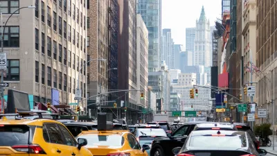
Using GPS technology and mapping, they've given individual travelers the means to spontaneously find the quickest, most efficient route to their destination quickly and easily. Any driver can already go to the city's website to find out if their route is congested. The traffic map tracks congestion on each road, color coding it for severe congestion (red), moderate congestion (yellow), and uncongested (green). Take a look at the map, which is updated every five seconds. The system is enabled by GPS chips traveling in 10,000 taxis throughout the city to give real time traffic conditions.
Then--and here's the innovative part--travelers can input their point of origin and destination. The system will plot the route, including distance and travel time. Then, the system will calculate the fastest alternative route. At our demonstration, which used a prototype touchscreen computer screen, going from downtown to the airport would usually be a 47 km trip. The fastest trip, however, was the 51 km route that used the fourth ring road.
Inaugurated in April 2006, the web site received 300,000 hits per day during its first week of use! The center is now looking for private partners to adapt the technology to cell phones and even install screens at public transit stations.
Leave it to Communist China to come up with a consumer-oriented, technology that makes traveling in the city faster and easier while recognizing the critical role the private sector plays in making it become a universal reality!
The Beijing system should be front and center at the National League of Cities, the Transportation Research Board, AASHTO, and any other group interested in improving urban mobility.

Agreement Keeps NYC Congestion Pricing Alive Through Summer
The tolling program will continue while a court considers the city’s lawsuit against the Trump administration.
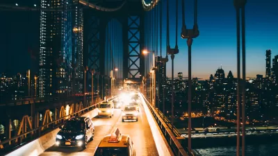
NYC Congestion Pricing Goes Into Effect
The long-awaited congestion pricing program began on January 5.
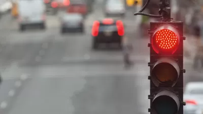
Boston AI Pilot Optimizes Traffic Light Timing
The program has led to reductions in stop-and-go traffic of as much as 50 percent.

Alabama: Trump Terminates Settlements for Black Communities Harmed By Raw Sewage
Trump deemed the landmark civil rights agreement “illegal DEI and environmental justice policy.”

Planetizen Federal Action Tracker
A weekly monitor of how Trump’s orders and actions are impacting planners and planning in America.

The 120 Year Old Tiny Home Villages That Sheltered San Francisco’s Earthquake Refugees
More than a century ago, San Francisco mobilized to house thousands of residents displaced by the 1906 earthquake. Could their strategy offer a model for the present?

In Both Crashes and Crime, Public Transportation is Far Safer than Driving
Contrary to popular assumptions, public transportation has far lower crash and crime rates than automobile travel. For safer communities, improve and encourage transit travel.

Report: Zoning Reforms Should Complement Nashville’s Ambitious Transit Plan
Without reform, restrictive zoning codes will limit the impact of the city’s planned transit expansion and could exclude some of the residents who depend on transit the most.

Judge Orders Release of Frozen IRA, IIJA Funding
The decision is a victory for environmental groups who charged that freezing funds for critical infrastructure and disaster response programs caused “real and irreparable harm” to communities.
Urban Design for Planners 1: Software Tools
This six-course series explores essential urban design concepts using open source software and equips planners with the tools they need to participate fully in the urban design process.
Planning for Universal Design
Learn the tools for implementing Universal Design in planning regulations.
Clanton & Associates, Inc.
Jessamine County Fiscal Court
Institute for Housing and Urban Development Studies (IHS)
City of Grandview
Harvard GSD Executive Education
Toledo-Lucas County Plan Commissions
Salt Lake City
NYU Wagner Graduate School of Public Service