


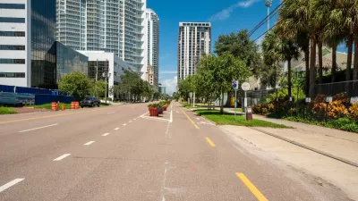
The draft plan targets improvements on 385 road segments.

The San Francisco Municipal Transportation Agency (SFMTA) board is set to review the city’s draft Biking and Rolling plan, which sets the goal of putting a “safe bike route” within a quarter mile of every resident’s home.
As Rachel Swan explains in the San Francisco Chronicle, “The current draft lists 385 routes or street segments that are targeted for upgrades, ranging from brighter striping on crosswalks, to barriers along bike lanes.” The city wants to encourage residents to use bikes for short, local trips by making neighborhood roads safer for kids and older riders, particularly near schools.
The plan calls for more interconnected bikeways, speed bumps, and other measures to improve safety and link existing bike lanes, as well as reducing conflicts between pedestrians and scooters. But it could face backlash from residents concerned about the loss of parking and driving lanes.
Swan adds, “Roads are a utility. But they also reflect a city’s values. For decades, San Franciscans have battled over how streets should function and which transportation modes should get priority. In recent years, SFMTA has reclaimed space from cars and dedicated it for bikes, scooters, or pedestrians, instituting a ‘quick-build’ process to streamline these projects.”
FULL STORY: S.F. to unveil its most ambitious bicycle plan in years, targeting hundreds of routes for upgrades

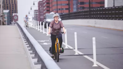
St. Petersburg’s Bike Infrastructure Efforts Pay Off
New bike infrastructure is encouraging more people to take to the streets on two wheels, but advocates say safety challenges remain.

Bike Resolutions for the New Year
A list of ways people can enhance their biking experience, appreciate the joy of cycling, and support safer bike infrastructure.
The Most Bike-Friendly States in the Nation
The League of American Bicyclists ranks states based on bike infrastructure and safety efforts.

Trump Administration Could Effectively End Housing Voucher Program
Federal officials are eyeing major cuts to the Section 8 program that helps millions of low-income households pay rent.

Planetizen Federal Action Tracker
A weekly monitor of how Trump’s orders and actions are impacting planners and planning in America.

Ken Jennings Launches Transit Web Series
The Jeopardy champ wants you to ride public transit.

Rebuilding Smarter: How LA County Is Guiding Fire-Ravaged Communities Toward Resilience
Los Angeles County is leading a coordinated effort to help fire-impacted communities rebuild with resilience by providing recovery resources, promoting fire-wise design, and aligning reconstruction with broader sustainability and climate goals.

When Borders Blur: Regional Collaboration in Action
As regional challenges outgrow city boundaries, “When Borders Blur” explores how cross-jurisdictional collaboration can drive smarter, more resilient urban planning, sharing real-world lessons from thriving partnerships across North America.

Philadelphia Is Expanding its Network of Roundabouts
Roundabouts are widely shown to decrease traffic speed, reduce congestion, and improve efficiency.
Urban Design for Planners 1: Software Tools
This six-course series explores essential urban design concepts using open source software and equips planners with the tools they need to participate fully in the urban design process.
Planning for Universal Design
Learn the tools for implementing Universal Design in planning regulations.
Ada County Highway District
Clanton & Associates, Inc.
Jessamine County Fiscal Court
Institute for Housing and Urban Development Studies (IHS)
City of Grandview
Harvard GSD Executive Education
Toledo-Lucas County Plan Commissions
Salt Lake City
NYU Wagner Graduate School of Public Service