


Tree-D Fusion, an AI-driven tool developed by MIT and Purdue researchers, generates 3D models of urban trees to help city planners visualize future green spaces, address climate challenges, and enhance urban livability and sustainability.
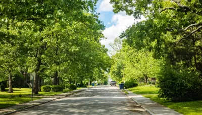
Tree-D Fusion, a groundbreaking system developed by researchers including the Massachusetts Institute of Technology (MIT)'s Sara Beery and Purdue University's Jae Joong Lee, uses AI to create 3D models of urban trees from 2D images, such as those from Google Street View. This tool leverages species- and environment-specific data to simulate realistic tree growth and predict how urban forests will evolve over time. Beyond visualizing the future of green spaces, the system offers cities a "living digital forest" to monitor environmental stresses and assess tree health, helping urban planners proactively manage tree growth and avoid issues like interference with power lines.
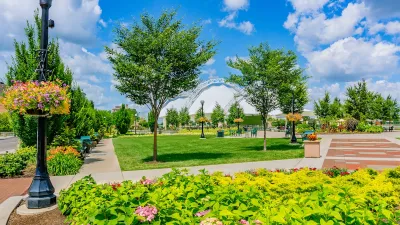
The technology also addresses broader urban challenges, such as combating the heat island effect and improving city livability amid climate change. By mapping intricate shade patterns and envisioning future green spaces, Tree-D Fusion enables planners to strategically cultivate urban forests that can cool cities and mitigate heat buildup. These efforts align with studies showing that access to green spaces significantly impacts public health, life expectancy, and social equity, emphasizing the importance of incorporating urban forestry into city planning.
Looking to the future, the creators of Tree-D Fusion aim to scale the platform globally, using AI insights to promote biodiversity, sustainability, and ecosystem health. Alongside complementary research, such as studies on the number of trees needed to cool cities like Los Angeles, the system exemplifies how technology can merge with ecological science to create greener, more resilient urban environments that benefit both people and the planet.
FULL STORY: Hey Google: Data Scientists Use AI to Plant New Forests in the Cities


A Framework for Inclusive Tree Planting in Los Angeles
The Los Angeles Urban Forest Equity Collective has developed an equity-centered tree-planting framework and toolkit to address historic underinvestment and mitigate extreme heat in vulnerable neighborhoods.
A Plan to Expand Tree Canopy Across Dayton
Dayton is developing an urban forest master plan, using a $2 million grant to expand its tree canopy, address decades of tree loss, and enhance environmental equity across the city.
Oakland Adopts Urban Forest Plan to Foster Equity and Environmental Justice
The Oakland City Council has adopted its first Urban Forest Plan, a 50-year roadmap focused on equitable tree care, canopy preservation, and environmental justice to benefit underserved communities.

Alabama: Trump Terminates Settlements for Black Communities Harmed By Raw Sewage
Trump deemed the landmark civil rights agreement “illegal DEI and environmental justice policy.”

Planetizen Federal Action Tracker
A weekly monitor of how Trump’s orders and actions are impacting planners and planning in America.

The 120 Year Old Tiny Home Villages That Sheltered San Francisco’s Earthquake Refugees
More than a century ago, San Francisco mobilized to house thousands of residents displaced by the 1906 earthquake. Could their strategy offer a model for the present?

Ken Jennings Launches Transit Web Series
The Jeopardy champ wants you to ride public transit.

BLM To Rescind Public Lands Rule
The change will downgrade conservation, once again putting federal land at risk for mining and other extractive uses.

Indy Neighborhood Group Builds Temporary Multi-Use Path
Community members, aided in part by funding from the city, repurposed a vehicle lane to create a protected bike and pedestrian path for the summer season.
Urban Design for Planners 1: Software Tools
This six-course series explores essential urban design concepts using open source software and equips planners with the tools they need to participate fully in the urban design process.
Planning for Universal Design
Learn the tools for implementing Universal Design in planning regulations.
Clanton & Associates, Inc.
Jessamine County Fiscal Court
Institute for Housing and Urban Development Studies (IHS)
City of Grandview
Harvard GSD Executive Education
Toledo-Lucas County Plan Commissions
Salt Lake City
NYU Wagner Graduate School of Public Service