


In 1960, about 12 percent of the Twin Cities metro's land was already developed. By 2020, about 34 percent had been developed. Many factors influenced how the region has changed since 1960.

What will the Minneapolis and St. Paul region look like in 2050? Looking at past development can inform our future, and a new update from the Metropolitan Council does just that.
In total, the seven metro region counties comprise about 1.8 million acres of land (excluding lakes and rivers). In 1960, about 12 percent of that land was already developed. By 2020, about 34 percent had been developed. (“Developed” means areas with built uses, excluding farming, parks, and preserved open space.)
Many factors influenced how the region has changed since 1960. But two critical ones have been the construction of the interstate highway system and the Metropolitan Council’s influence over development through staging of regional wastewater service.
Interstates allow people to move further from job centers
In 1960, 52 percent of the seven-county metro population lived in Minneapolis and Saint Paul, the region’s major employment centers. By 1980, only 32 percent of the population lived in the two central cities. The construction of I-94, I-35, and I-494/694 approximately tripled the land supply within a 30-minute drive of the region’s core, explained Todd Graham, Met Council principal researcher.
Not only did the modern highway network allow more people to live in suburbs and exurbs, but employment centers also started to shift into the suburbs. In 1962, 3M Company opened its first building in Maplewood. New indoor shopping malls (the “Dales”) sprang up in Edina, Minnetonka, Roseville, and Brooklyn Center, creating areas for more commercial and industrial growth.
“I-494 through Bloomington and Richfield has become one of the largest employment centers in the region,” Graham said. “This suburbanization of jobs allowed more people to live in more places.”
Sewer policies help reduce household sewer rates
In 1967, the Minnesota Legislature recognized two urgent needs: stop pollution to area lakes and rivers from failing local sewage treatment plants, and plan for the orderly and economical development of the growing metro region.
The legislature created the Met Council to plan for growth, a metro sewer board to operate a regional sewer system, and a transit commission to operate the bus system. (In 1994, the legislature merged all three agencies.)
Over time, the concept of a metropolitan urban service area, or MUSA, emerged to define where regional wastewater collection and treatment would be provided. Key considerations were:
- Ensuring enough land supply to accommodate forecasted growth on a 20- to 30-year planning horizon
- Capacity of the local and regional sewer systems
- New development served by sewer would be contiguous with existing sewered development
MUSA policies and implementation have evolved in response to changing development demands, according to Lisa Barajas, Met Council community development director. But a key goal has always been to ensure that urban services support planned development cost-efficiently. As a result, household sewer costs in our region are about 35% lower than the national average for peer systems.
National trends impact growth
Economic cycles have impacted regional growth. In the 1990s, when the national economy boomed, the region developed more than 86,000 acres of land – greater than in any decade earlier or since.
Demographics have also influenced development. Starting in the 1960s, the huge baby boom generation started reaching adulthood and buying homes, which boosted land consumption.
More choices, balanced growth reduces land consumption
Since 2010, the demographic makeup of people looking for homes has diversified; there are more senior households, more 1- and 2-person households, and a growing population of color. This greater diversity is accompanied by more varied housing preferences – not just the single-family house in the suburbs.
In the 2010s, apartment building construction reached record levels. Single-family detached homebuilding fell to 51,000 houses per decade – half the homebuilding production experienced in the peak 1990s, and the lowest pace since World War II. On average, single-family detached houses consume 12 times more land than the same number of apartments or condos. As a result, land consumption in the 2010s was half that of the 1990s.
The Met Council has also supported less land consumption by providing Livable Communities grants to cities. The grants help fund affordable housing and development along transitways, giving people the choice to live without a car. A 2023 Metro Transit report found that between 2009 and 2022, 43% of the region’s multifamily development by permit value were permitted along high frequency transit, representing 55,200 housing units.
Forecasting regional and local growth to 2050
The Met Council is also responsible for developing forecasts of when, where, and how much growth the seven-county region and local jurisdictions can expect over a 30-year horizon. Long-range forecasts provide a shared foundation for coordinated comprehensive planning.
After receiving public comments on the latest forecasts for the draft regional development guide, Imagine 2050, the Met Council has finalized the forecasts for local population growth, as these projections serve as the basis for local comprehensive planning. Imagine 2025, including the forecasts, are scheduled for adoption on Feb. 12.
The Met Council’s Generalized Land Use Inventory is a tool we use to track development trends and how the region is doing against our land use objectives and assist in forecasting. We use aerial photography, assessors’ information, building permits, and internet searches to determine land uses and use changes. The next inventory is scheduled to be completed in 2026.
FULL STORY: Looking back on 60 years of land development in the Twin Cities metro


Twin Cities Suburbs Look to Improve Bike Facilities
Communities around Minneapolis and St. Paul are working to build more robust bike infrastructure networks.
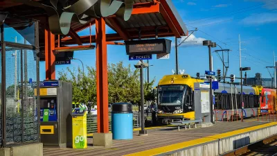
Twin Cities Trains Move to Fewer Cars, Higher Frequency
Headways will drop from 15 minutes to 12 minutes.

Twin Cities Parking Reform Shows Promising Results
Minneapolis and St. Paul both eliminated parking minimums, paving the way for less parking and more housing.

Manufactured Crisis: Losing the Nation’s Largest Source of Unsubsidized Affordable Housing
Manufactured housing communities have long been an affordable housing option for millions of people living in the U.S., but that affordability is disappearing rapidly. How did we get here?

Americans May Be Stuck — But Why?
Americans are moving a lot less than they once did, and that is a problem. While Yoni Applebaum, in his highly-publicized article Stuck, gets the reasons badly wrong, it's still important to ask: why are we moving so much less than before?

Using Old Oil and Gas Wells for Green Energy Storage
Penn State researchers have found that repurposing abandoned oil and gas wells for geothermal-assisted compressed-air energy storage can boost efficiency, reduce environmental risks, and support clean energy and job transitions.

Updating LA’s Tree Rules Could Bring More Shade to Underserved Neighborhoods
A new USC study finds that relaxing Los Angeles’ outdated tree planting guidelines could significantly expand urban tree canopy and reduce shade disparities in lower-income neighborhoods, though infrastructure investments are also needed.

California's Canal Solar Projects Aim to Conserve Resources and Expand Clean Energy
California’s Project Nexus has begun generating electricity from solar panels installed over irrigation canals, with researchers and state agencies exploring statewide expansion to conserve water and boost clean energy production.

HHS Staff Cuts Gut Energy Assistance Program
The full staff of a federal program that distributes heating and cooling assistance for low-income families was laid off, jeopardizing the program’s operations.
Urban Design for Planners 1: Software Tools
This six-course series explores essential urban design concepts using open source software and equips planners with the tools they need to participate fully in the urban design process.
Planning for Universal Design
Learn the tools for implementing Universal Design in planning regulations.
Heyer Gruel & Associates PA
City of Moreno Valley
Institute for Housing and Urban Development Studies (IHS)
City of Grandview
Harvard GSD Executive Education
Salt Lake City
NYU Wagner Graduate School of Public Service
City of Cambridge, Maryland