


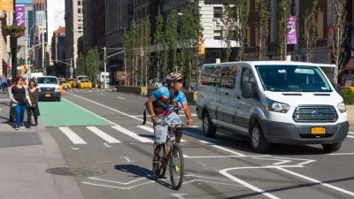
Users of the mobile travel planning app can now prioritize safe bike infrastructure when trip planning.

A new update to the Transit travel planning mobile app will let users prioritize safe bike routes, reports George Kevin Jordan in Streetsblog USA.
“Go Bike, from Montreal-based company Transit, now allows users to make biking their first mode of transit, shows safer bike routes first, and provides multiple bike route options.” The app is asking users to contribute information to ensure accurate data.
As Jordan explains, “Companies like Apple and Google have had hiccups and complaints about their navigation apps for cyclists, and while they have made improvements, there’s still a pathway for other competitors to create or improve their navigation services for users.”
For years, users struggled to find information about bike lanes, traffic lights, and safe routes using mapping apps. Now, “The app will display a route, and the percentage of bike lanes and paths on the journey, then orders them by safety first. So users will get directed to protected bike paths, then bike lanes, then residential streets, before the app offers up busy car-dominated roads.”
FULL STORY: Transit App Now Provides Safety-First Bike Directions

New York Cyclist Deaths Spike, Worrying Bike Advocates
The number of people killed on bikes in the city has already surpassed 2018’s total for the entire year.

Houston Mayor Promises Dedicated Austin Street Bike Lane After Public Backlash
Although the one-way bike lane won’t be protected by physical barriers, the proposal is an improvement over the mayor’s initial plan to only include sharrows on the Austin Street project.
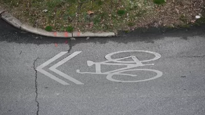
Sharrows Are Ineffective, Potentially Counterproductive
Research shows there’s no substitute for protected bike lanes, and sharrows may make roads more dangerous for cyclists.

Alabama: Trump Terminates Settlements for Black Communities Harmed By Raw Sewage
Trump deemed the landmark civil rights agreement “illegal DEI and environmental justice policy.”

Planetizen Federal Action Tracker
A weekly monitor of how Trump’s orders and actions are impacting planners and planning in America.

The 120 Year Old Tiny Home Villages That Sheltered San Francisco’s Earthquake Refugees
More than a century ago, San Francisco mobilized to house thousands of residents displaced by the 1906 earthquake. Could their strategy offer a model for the present?

Ken Jennings Launches Transit Web Series
The Jeopardy champ wants you to ride public transit.

BLM To Rescind Public Lands Rule
The change will downgrade conservation, once again putting federal land at risk for mining and other extractive uses.

Indy Neighborhood Group Builds Temporary Multi-Use Path
Community members, aided in part by funding from the city, repurposed a vehicle lane to create a protected bike and pedestrian path for the summer season.
Urban Design for Planners 1: Software Tools
This six-course series explores essential urban design concepts using open source software and equips planners with the tools they need to participate fully in the urban design process.
Planning for Universal Design
Learn the tools for implementing Universal Design in planning regulations.
Clanton & Associates, Inc.
Jessamine County Fiscal Court
Institute for Housing and Urban Development Studies (IHS)
City of Grandview
Harvard GSD Executive Education
Toledo-Lucas County Plan Commissions
Salt Lake City
NYU Wagner Graduate School of Public Service