


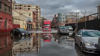
Agency-funded projects will be required to be elevated at least 2 feet above the projected local flood level.

A new policy from the Federal Emergency Management Agency (FEMA) will require projects using FEMA funding to demonstrate improved resilience, reports Julie Strupp for Construction Dive.
“Starting Sept. 9 new projects and infrastructure rebuilt after a disaster with FEMA funding must be elevated at least 2 feet above the area flood level, using up-to-date data and accounting for likely impacts of climate change, per the new Federal Flood Risk Management Standard,” Strupp explains. The rule aims to build resilience into the reconstruction process to protect infrastructure from future flooding.
The agency says previous approaches are outdated due to growing flood risk. “FEMA’s new standards will increase the flood elevation and the floodplain in order to reflect both current and future flood risk. The requirement that jurisdictions account for flooding that is likely to occur in the future under climate change is new.”
The new rule will apply to roughly 35,000 FEMA-funded projects in the next decade “involving new construction, substantial improvement or repairs to substantial damage, as well as to Hazard Mitigation Assistance projects involving structure elevation, dry floodproofing and mitigation reconstruction.”
FULL STORY: Federal infrastructure projects get a (flood) raise

FEMA Resilience Program Cuts Grant Funding
The Building Resilient Infrastructure and Communities program funded projects from flood prevention to power station upgrades.
New Study Reveals Massive, Unaccounted Flood Risk
The Federal Emergency Management Agency undercounts the humber of homes at substantial risk of flooding by some 70 percent, according to a report released this week.
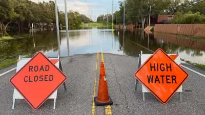
FEMA Suspends Flood Rebuilding Standard
The rule was designed to prevent the rebuilding of government-funded projects in areas prone to repeated floods.

Alabama: Trump Terminates Settlements for Black Communities Harmed By Raw Sewage
Trump deemed the landmark civil rights agreement “illegal DEI and environmental justice policy.”

Planetizen Federal Action Tracker
A weekly monitor of how Trump’s orders and actions are impacting planners and planning in America.

The 120 Year Old Tiny Home Villages That Sheltered San Francisco’s Earthquake Refugees
More than a century ago, San Francisco mobilized to house thousands of residents displaced by the 1906 earthquake. Could their strategy offer a model for the present?

Ken Jennings Launches Transit Web Series
The Jeopardy champ wants you to ride public transit.

BLM To Rescind Public Lands Rule
The change will downgrade conservation, once again putting federal land at risk for mining and other extractive uses.

Indy Neighborhood Group Builds Temporary Multi-Use Path
Community members, aided in part by funding from the city, repurposed a vehicle lane to create a protected bike and pedestrian path for the summer season.
Urban Design for Planners 1: Software Tools
This six-course series explores essential urban design concepts using open source software and equips planners with the tools they need to participate fully in the urban design process.
Planning for Universal Design
Learn the tools for implementing Universal Design in planning regulations.
Clanton & Associates, Inc.
Jessamine County Fiscal Court
Institute for Housing and Urban Development Studies (IHS)
City of Grandview
Harvard GSD Executive Education
Toledo-Lucas County Plan Commissions
Salt Lake City
NYU Wagner Graduate School of Public Service