


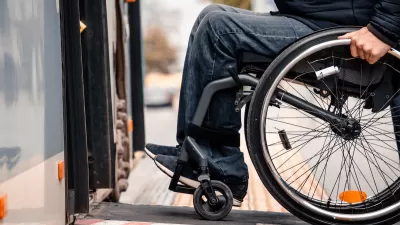
The app provides navigation using audio and haptic cues to improve accessibility for people with low vision.

A mobile app helps transit riders with vision impairment plan trips more easily, interpreting signage and incorporating scheduling information. As Maylin Tu writes in Next City, the app was developed by Spain-based NaviLens and “uses codes posted at bus stops or in train stations to provide real-time navigation via audio and haptic (vibration) cues, directing the user from the elevator in a train station, for example, to a nearby bus stop.” Agencies including the New York City MTA have adopted the system. Last year, Vancouver’s TransLink agency launched a six-month pilot program at 16 stops to evaluate the effectiveness of the NaviLens system.
Like other accessibility features, designing public facilities for people with vision impairments can benefit other groups as well. “To improve wayfinding, [accessibility consultant Richard Marion] recommends that transit agencies focus on consistent and high-contrast signage across a region, so that people with some sight loss can easily distinguish between a no parking sign and a bus stop, for example, even if they don’t read braille. Making bus stops easy to identify would be helpful for wayfinding in general.”
FULL STORY: An App That Helps Riders With Vision Loss Navigate Complex Transit Systems

How to Improve Transit Accessibility
Over 13 million Americans face mobility challenges that limit their travel experience.
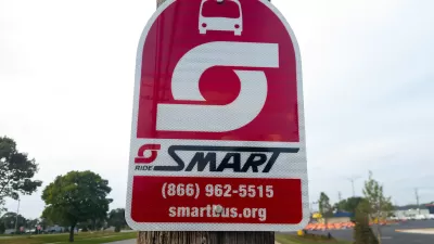
Website Streamlines Michigan Transit Information
The tool is designed to help people with disabilities navigate the state’s complex public transit network.
How Car Dependency Impacts People With Disabilities
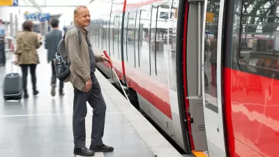
People who are physically unable to drive can benefit from effective public transit systems and accessible, mixed-use neighborhoods.

Alabama: Trump Terminates Settlements for Black Communities Harmed By Raw Sewage
Trump deemed the landmark civil rights agreement “illegal DEI and environmental justice policy.”

Planetizen Federal Action Tracker
A weekly monitor of how Trump’s orders and actions are impacting planners and planning in America.

The 120 Year Old Tiny Home Villages That Sheltered San Francisco’s Earthquake Refugees
More than a century ago, San Francisco mobilized to house thousands of residents displaced by the 1906 earthquake. Could their strategy offer a model for the present?

In Both Crashes and Crime, Public Transportation is Far Safer than Driving
Contrary to popular assumptions, public transportation has far lower crash and crime rates than automobile travel. For safer communities, improve and encourage transit travel.

Report: Zoning Reforms Should Complement Nashville’s Ambitious Transit Plan
Without reform, restrictive zoning codes will limit the impact of the city’s planned transit expansion and could exclude some of the residents who depend on transit the most.

Judge Orders Release of Frozen IRA, IIJA Funding
The decision is a victory for environmental groups who charged that freezing funds for critical infrastructure and disaster response programs caused “real and irreparable harm” to communities.
Urban Design for Planners 1: Software Tools
This six-course series explores essential urban design concepts using open source software and equips planners with the tools they need to participate fully in the urban design process.
Planning for Universal Design
Learn the tools for implementing Universal Design in planning regulations.
Clanton & Associates, Inc.
Jessamine County Fiscal Court
Institute for Housing and Urban Development Studies (IHS)
City of Grandview
Harvard GSD Executive Education
Toledo-Lucas County Plan Commissions
Salt Lake City
NYU Wagner Graduate School of Public Service