


City Profiles
Explore cities through an urban planning lens.
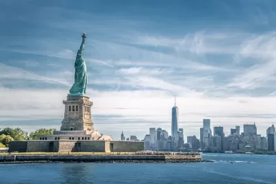
New York City: An Urban Planner's Guide to the City
One of the earliest urban centers in the United States, New York City is a vibrant, multicultural city with a complex set of challenges ahead of it.
Basics
- State: New York
- Incorporation date: January 1, 1898
- Area: 472.43 square miles
- Statehood: July 26, 1788
- Population*: 8,175,133
- Type of government: Strong mayor-council
- Planning department website: Department of City Planning
- Comprehensive plan: Planning Together
*Current as of 2020 Census.
Indigenous occupants of New York City region
The area of present-day New York City was historically inhabited by Indigenous groups including the Lenape, a loose group of Algonquian people with related languages. Their historic homeland, known as Lenapehoking, stretched from the Lower Hudson area to Delaware Bay, covering parts of what are today New York, New Jersey, Pennsylvania, and Delaware. The group in the New York City area was named the Munsee. They practiced small-scale farming as well as seasonal hunting, fishing, and gathering until they were displaced by European colonists through war and disease.
Today, many of the remaining Lenape people live in Oklahoma, Ontario, and Wisconsin. In New York, traces of their cultural influence remain in present-day geography: Broadway, for example, roughly follows a Lenape trade route.
Colonization of New York City
Although the taking of Manhattan Island from the Lenape is often called a “sale” in historical records, scholars say the transaction was far from consensual. According to researchers, the Lenape probably viewed the purported “sale” as an agreement to share the land with the newcomers rather than cede it altogether.
When European colonization began, the area around New York Harbor was first claimed for the French. After 1609, Henry Hudson and others claimed the area for the Netherlands. By 1625, the Dutch were building Fort Amsterdam on what is today Manhattan Island. The Dutch ceded the area to the English in 1664, making it part of New York Colony.
In the 1700s, New York thrived as a center of commerce and the slave trade. It became the largest city in the country in 1790, and by the end of the 19th century, the population grew to over 3 million. It became the first national capital under the U.S. Constitution and hosted Congressional meetings and the first Supreme Court. The city continued to grow in importance as a center for immigration, international commerce, and banking in the 19th century.
20th century growth: New York skyline, urban landscape, and economy
The early 20th century saw a boom in high-rise building construction, creating the city’s iconic skyline. In 1916, the city passed the first zoning ordinance in the United States as a response to worsening urban conditions and a growing recognition of the need to separate land uses to keep residential areas away from noxious industrial uses. The ordinance also defined the maximum volume of buildings based on lot size, shifting away from the conventional focus on purely building height. Economic and population growth continued in the post-World War II era and ramped up in the 1980s and 1990s, when New York regained its reputation as a key global financial center.
21st century concerns: Housing affordability, traffic and transit, and resiliency
A notoriously expensive city, New York saw housing costs rise during the Covid-19 pandemic, and they have remained at unaffordable highs for many residents. High housing costs and the lack of an ample affordable housing supply for low-income families will continue to plague the city as it recovers from the shocks of the pandemic.
After a drawn-out and controversial process, New York became the first U.S. city to implement a congestion pricing program in 2024. The program, which takes effect in May 2024, could be a model for other cities and encourages off-peak driving and transit use to reduce congestion and emissions in the central city.
Like other major cities in the post-Covid-19 era, New York City’s commercial districts saw a sharp drop in the occupancy rates of office buildings, which experts believe may never recover to pre-pandemic levels as more companies see the benefits of remote or hybrid work. The city launched an office conversion initiative to support the adaptive reuse of office buildings into housing and other uses.
Sea level rise, coastal erosion, and subsidence are threatening New York’s coastal neighborhoods. Hurricane Sandy, among other extreme weather events, highlighted the need to build more robust resilience infrastructure to face increasingly unpredictable storms. The city is undertaking resiliency projects to reinforce its shorelines and mitigate flooding risk in its most vulnerable neighborhoods.
Key planning milestones for New York City
-
1811: The Commissioners' Plan of 1811 outlines a city street grid that covers most of downtown Manhattan, strictly delineated public and private spaces.
-
1825: The Erie Canal opens, connecting New York’s port to inland markets.
-
1842: Water is piped into the city for the first time.
-
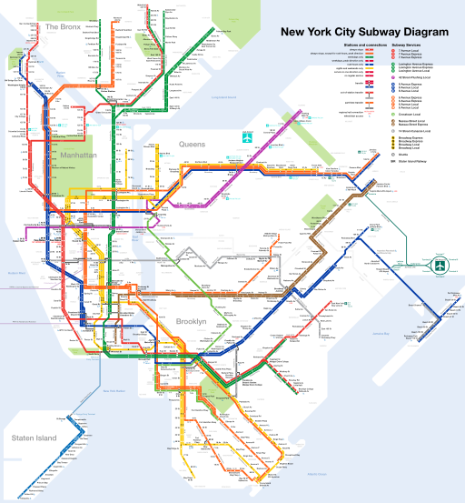
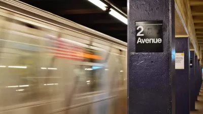
1904: The first underground New York City subway line opened and to this day is one of the oldest mass public transportation systems.
-
1916: The city passes the first citywide zoning code in the United States as a response to worsening urban conditions and concerns about separation of uses,building heights, light, and air. The code influenced architecture and building codes worldwide and introduced the concept of the ‘zoning envelope.’
-
1925: New York becomes the most populous city in the world, topping London.
-
1936: The City Charter establishes the Department of City Planning and City Planning Commission.
-
1961: A new zoning resolution overrules the 1916 code, using Floor Area Ratio (FAR) instead of building height to regulate development to increase public open space adjacent to buildings. The new code also coordinated use and bulk regulations, incorporated new minimum parking requirements.
-
1969: The first special purpose districts are established, starting with the Special Lincoln Square District, to preserve and protect the unique characteristics of certain neighborhoods.
-
1975: The Uniform Land Use Review Procedure (ULURP) is created to standardize the development review process. It includes Community Board review.
-
2023: City approves congestion pricing program for parts of Manhattan, the first such program in the nation.
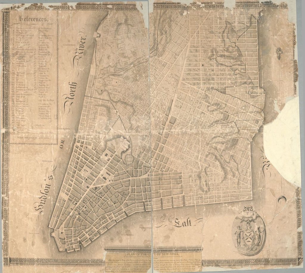
Image credit: New York Public Library Digital Collections

They Had No Heat for Months. A New Law Let Them Sue.
In New York state, tenants can now take landlords to court directly to force repairs and get damages, without withholding rent first. Here’s how one of the first tests of the new law worked.
New York Governor Announces 2024 Transportation Plans
Gov. Hochul’s plans include the long-awaited Second Avenue Subway extension.

Main Street Redevelopment Hopes To Lure NYC Commuters to Village of Brewster
Officials in the Village of Brewster, a community of just over 2,000 people in New York's Putnam County, hope a redesign of their downtown will attract new residents who want to escape the clamor of the city.


Urban Design for Planners 1: Software Tools
This six-course series explores essential urban design concepts using open source software and equips planners with the tools they need to participate fully in the urban design process.
Planning for Universal Design
Learn the tools for implementing Universal Design in planning regulations.
Heyer Gruel & Associates PA
City of Moreno Valley

Institute for Housing and Urban Development Studies (IHS)
City of Grandview
Harvard GSD Executive Education
Salt Lake City
NYU Wagner Graduate School of Public Service
City of Cambridge, Maryland