


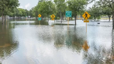
Most of the census tracts designated at high risk of flooding are in less affluent neighborhoods.
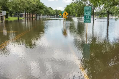
A report from First Street Foundation highlights the parts of Houston designated as “climate abandonment areas,” census tracts that households are leaving in part due to climate change-related flood risk. These households are not being replaced by new incoming residents. Roy Kent describes the report in the Kinder Institute for Urban Research’s Urban Edge, which notes that 9 percent of Harris County census tracts are abandonment areas.
Climate abandonment areas include the cost of a home based on its location along with the added costs associated with higher rates for homeowners and flood insurance policies. Higher costs often drive some homeowners out of the neighborhood to nearby areas with lower insurance rates due to a lower flood chance.
According to the report, “climate abandonment areas of Houston are predominately in less affluent neighborhoods with older infrastructure spread across the city but generally located inside the 610 Loop.”
Jeremy Porter, head of climate implications research at First Street, says “The downstream implications of this are massive and impact property values, neighborhood composition and commercial viability both positively and negatively.”
The report notes that Texas has faced the highest disaster recovery costs of all states, with over $300 billion in damage from tropical storms and hurricanes, droughts, and winter storms since 1980.
FULL STORY: Residents leave Houston neighborhoods thanks in part to climate change


Rising Above: Innovative Solutions for Waikīkī’s Sea-Level Challenges
The University of Hawaiʻi at Mānoa’s award-winning Waikīkī sea-level rise adaptation project combines science, architecture, and community input to create scalable solutions for climate resilience and coastal flood mitigation.
Houston-Area Flood Insurance Costs Eat Into Region's Affordability
A reorganization of FEMA’s flood insurance program will mean increases in insurance costs for coastal homeowners.
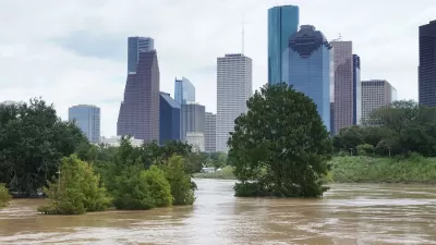
Houston Flooding: Climate Change or Development Patterns to Blame?
The Guardian's former environmental editor asks if urban sprawl is as much to blame as climate change for the flooding caused by Hurricane Harvey in Houston.

Alabama: Trump Terminates Settlements for Black Communities Harmed By Raw Sewage
Trump deemed the landmark civil rights agreement “illegal DEI and environmental justice policy.”

Study: Maui’s Plan to Convert Vacation Rentals to Long-Term Housing Could Cause Nearly $1 Billion Economic Loss
The plan would reduce visitor accommodation by 25% resulting in 1,900 jobs lost.

Planetizen Federal Action Tracker
A weekly monitor of how Trump’s orders and actions are impacting planners and planning in America.

Waymo Gets Permission to Map SF’s Market Street
If allowed to operate on the traffic-restricted street, Waymo’s autonomous taxis would have a leg up over ride-hailing competitors — and counter the city’s efforts to grow bike and pedestrian on the thoroughfare.

Parklet Symposium Highlights the Success of Shared Spaces
Parklets got a boost during the Covid-19 pandemic, when the concept was translated to outdoor dining programs that offered restaurants a lifeline during the shutdown.

Federal Homelessness Agency Places Entire Staff on Leave
The U.S. Interagency Council on Homelessness is the only federal agency dedicated to preventing and ending homelessness.
Urban Design for Planners 1: Software Tools
This six-course series explores essential urban design concepts using open source software and equips planners with the tools they need to participate fully in the urban design process.
Planning for Universal Design
Learn the tools for implementing Universal Design in planning regulations.
Caltrans
Smith Gee Studio
Institute for Housing and Urban Development Studies (IHS)
City of Grandview
Harvard GSD Executive Education
Toledo-Lucas County Plan Commissions
Salt Lake City
NYU Wagner Graduate School of Public Service