


The interactive map details zoning rules along with local services like sanitation, transportation, and more.
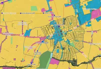
A new interactive ‘zoning atlas’ offers Long Island residents a way to understand the complex web of land use, municipal services, transportation, and zoning districts on the island. As Desiree D'Iorio explains in a piece for WSHU, “It can be filtered to show details like public transportation routes, downtown areas, current land use and special districts for services like sewers, schools, ambulances and sanitation.”
Gwen O'Shea, president of Community Development Long Island, said the tool can help governments and builders understand what type of housing is permitted where and how those regulations intersect with services like transit. “It can help developers see what building opportunities are available, and help officials and housing advocates understand how housing policies impact homeowners and communities.”
FULL STORY: New tool hopes to change how Long Island understands its complex zoning


Barriers to Integration Come Down Slowly in Wealthy, White Suburban Enclaves
Beware of possible code words like "character" and "flavor" when it comes to community resistance to multifamily housing or increased density. Case in point, Garden City, Long Island.
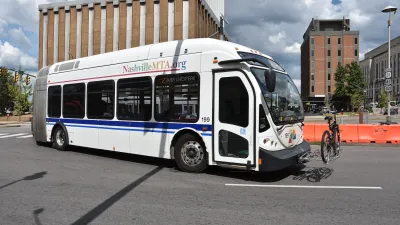
Report: Zoning Reforms Should Complement Nashville’s Ambitious Transit Plan
Without reform, restrictive zoning codes will limit the impact of the city’s planned transit expansion and could exclude some of the residents who depend on transit the most.

Texas Churches Rally Behind ‘Yes in God’s Back Yard’ Legislation
Religious leaders want the state to reduce zoning regulations to streamline leasing church-owned land to housing developers.

Alabama: Trump Terminates Settlements for Black Communities Harmed By Raw Sewage
Trump deemed the landmark civil rights agreement “illegal DEI and environmental justice policy.”

Planetizen Federal Action Tracker
A weekly monitor of how Trump’s orders and actions are impacting planners and planning in America.

The 120 Year Old Tiny Home Villages That Sheltered San Francisco’s Earthquake Refugees
More than a century ago, San Francisco mobilized to house thousands of residents displaced by the 1906 earthquake. Could their strategy offer a model for the present?

Ken Jennings Launches Transit Web Series
The Jeopardy champ wants you to ride public transit.

BLM To Rescind Public Lands Rule
The change will downgrade conservation, once again putting federal land at risk for mining and other extractive uses.

Indy Neighborhood Group Builds Temporary Multi-Use Path
Community members, aided in part by funding from the city, repurposed a vehicle lane to create a protected bike and pedestrian path for the summer season.
Urban Design for Planners 1: Software Tools
This six-course series explores essential urban design concepts using open source software and equips planners with the tools they need to participate fully in the urban design process.
Planning for Universal Design
Learn the tools for implementing Universal Design in planning regulations.
Clanton & Associates, Inc.
Jessamine County Fiscal Court
Institute for Housing and Urban Development Studies (IHS)
City of Grandview
Harvard GSD Executive Education
Toledo-Lucas County Plan Commissions
Salt Lake City
NYU Wagner Graduate School of Public Service