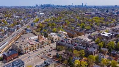
The century-old rule has shaped the District’s iconic horizontal skyline, but some Council members say it need revision in light of the region’s growing housing crisis.

The height limit that has long dominated the development of Washington, D.C.’s skyline is coming into question as District leaders seek to bring more housing units and residents to the central core as part of Mayor Bowser’s Comeback Plan. “A key goal of this plan is to ‘add 15,000 residents to the Downtown population by adding seven million square feet of residential units,’” writes Luke Garrett for WTOP.
The Height of Buildings Act, passed in 1910, limits building heights to 90 feet on residential streets and 130 feet on commercial corridors. Now, some District Council members are calling for changes to the century-old act as part of efforts to revitalize the city and adapt to changing housing and office space needs. “The District needs to address its affordable housing crisis through more density, so the Height Act should be on the table for negotiation as a way to increase density and housing units,” said Council member Zachary Parker.
Opponents of changing the Height Act say the District’s flat skyline is a “unique and defining characteristic.” Others call proposed changes to the Height Act a red herring, with Council member Brianne Nadeau saying that “We could double the amount of housing in the city right now if we updated the zoning code, even with the Height Act in place.”
FULL STORY: Why DC’s Height Act may fall this time

Alabama: Trump Terminates Settlements for Black Communities Harmed By Raw Sewage
Trump deemed the landmark civil rights agreement “illegal DEI and environmental justice policy.”

Planetizen Federal Action Tracker
A weekly monitor of how Trump’s orders and actions are impacting planners and planning in America.

The 120 Year Old Tiny Home Villages That Sheltered San Francisco’s Earthquake Refugees
More than a century ago, San Francisco mobilized to house thousands of residents displaced by the 1906 earthquake. Could their strategy offer a model for the present?

In Both Crashes and Crime, Public Transportation is Far Safer than Driving
Contrary to popular assumptions, public transportation has far lower crash and crime rates than automobile travel. For safer communities, improve and encourage transit travel.

Report: Zoning Reforms Should Complement Nashville’s Ambitious Transit Plan
Without reform, restrictive zoning codes will limit the impact of the city’s planned transit expansion and could exclude some of the residents who depend on transit the most.

Judge Orders Release of Frozen IRA, IIJA Funding
The decision is a victory for environmental groups who charged that freezing funds for critical infrastructure and disaster response programs caused “real and irreparable harm” to communities.
Urban Design for Planners 1: Software Tools
This six-course series explores essential urban design concepts using open source software and equips planners with the tools they need to participate fully in the urban design process.
Planning for Universal Design
Learn the tools for implementing Universal Design in planning regulations.
Clanton & Associates, Inc.
Jessamine County Fiscal Court
Institute for Housing and Urban Development Studies (IHS)
City of Grandview
Harvard GSD Executive Education
Toledo-Lucas County Plan Commissions
Salt Lake City
NYU Wagner Graduate School of Public Service


