


Location intelligence is transforming decision-making, with an increasing number and type of organizations modernizing operations with a geographic approach to problem-solving, planning, and prediction.
Location intelligence is the process of deriving meaningful insights from geospatial data to solve specific problems. This involves layering multiple data sets spatially and/or chronologically, for easy reference on a map, and its applications span industries, categories, and organizations. Location intelligence is facilitated by the use of geographical information system (GIS) tools which enable analysts to effectively and efficiently collect, stores, analyze, and visualize data.
Location intelligence experts can use a variety of spatial and business analytical tools to measure optimal locations for operating a business or providing a service. They begin with defining the business ecosystem which is influenced by many interconnected factors, including (but are not limited to): culture, lifestyle, labor, healthcare, cost of living, crime, economic climate, and education.
In this post, Esri, the well-known GIS software company, explains how leaders in business and government are applying location technology to meet a wide variety of needs. Examples of location intelligence use cases include finding optimal locations in retail site selection, managing assets in real time, supply chain optimization, and building or maintaining vital infrastructure. Esri points out that location is key to solving many of today's challenges as geography pulls together all key information about important issues such as infrastructure modernization, sustainability, climate change, environmental management, and social equity.
FULL STORY: Location Intelligence: Insights that transform decision-making


Explore US Demographics With the New ACS Atlas Collection
Esri's new ACS Atlas Collection offers interactive applications that visualize the latest U.S. demographic and socio-economic data, enabling users to explore over 175 curated web maps across various thematic areas.

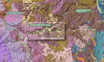
New Book Shows How Geographic Technology Tackles Global Challenges
In his new book, Jack Dangermond explores the transformative impact of GIS technology in solving global challenges through spatial data, highlighting its widespread application across sectors and its potential to design sustainable futures.

Building Healthier Communities: The Role of GIS in Park Planning
Integrating Geographic Information Systems (GIS) into park planning enhances community health by promoting physical activity, supporting mental well-being, fostering social connectedness, and addressing public health crises and climate change.

Alabama: Trump Terminates Settlements for Black Communities Harmed By Raw Sewage
Trump deemed the landmark civil rights agreement “illegal DEI and environmental justice policy.”

Planetizen Federal Action Tracker
A weekly monitor of how Trump’s orders and actions are impacting planners and planning in America.

How Atlanta Built 7,000 Housing Units in 3 Years
The city’s comprehensive, neighborhood-focused housing strategy focuses on identifying properties and land that can be repurposed for housing and encouraging development in underserved neighborhoods.

In Both Crashes and Crime, Public Transportation is Far Safer than Driving
Contrary to popular assumptions, public transportation has far lower crash and crime rates than automobile travel. For safer communities, improve and encourage transit travel.

Report: Zoning Reforms Should Complement Nashville’s Ambitious Transit Plan
Without reform, restrictive zoning codes will limit the impact of the city’s planned transit expansion and could exclude some of the residents who depend on transit the most.

Judge Orders Release of Frozen IRA, IIJA Funding
The decision is a victory for environmental groups who charged that freezing funds for critical infrastructure and disaster response programs caused “real and irreparable harm” to communities.
Urban Design for Planners 1: Software Tools
This six-course series explores essential urban design concepts using open source software and equips planners with the tools they need to participate fully in the urban design process.
Planning for Universal Design
Learn the tools for implementing Universal Design in planning regulations.
Jessamine County Fiscal Court
Caltrans
Institute for Housing and Urban Development Studies (IHS)
City of Grandview
Harvard GSD Executive Education
Toledo-Lucas County Plan Commissions
Salt Lake City
NYU Wagner Graduate School of Public Service