


A new tool uses aerial image recognition to map a city’s sidewalks and crosswalks. Its developers hope it will aid in creating a more comprehensive understanding of pedestrian networks and where improvements are needed.
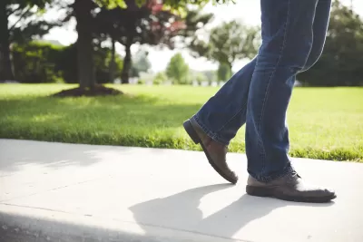
For many Americans, walking is an essential part of their daily trips to transit stops, schools, jobs, and other destinations. But as Peter Disikes explains for the MIT News Office, “Most cities and towns in the U.S. do not have sidewalk maps, and pedestrians are usually left to fend for themselves.”
Thanks to an effort led by researchers from MIT and other universities, “an open-source tool that uses aerial imagery and image-recognition to create complete maps of sidewalks and crosswalks” is now helping to bridge the information gap and provide planners and policymakers with a way to accurately assess the state of their city’s sidewalk network. “The tool, called TILE2NET, has been developed using a few U.S. areas as initial sources of data, but it can be refined and adapted for use anywhere.”
While many cities have incomplete sidewalk systems, advocating for expanding them is difficult without access to hard data. “The whole world of urban data for public transit and pedestrians and bicycles is really far behind [vehicle data] in quality. Analyzing how cities can be operational without a car requires this kind of data,” says Andres Sevtsuk, associate professor at MIT.
FULL STORY: Where the sidewalk ends

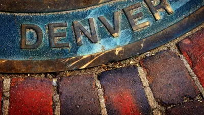
Denver Takes on Sidewalk Repair
The Colorado capital is the largest U.S. city to commit to maintaining its entire sidewalk network, funding repairs through a fee on property owners.
Chicago Allocates $500K to Sidewalk Clearing Pilot
Advocates of the Plow the Sidewalks program were asking for $1 million to start a pilot program in four areas of the city.
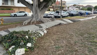
The City of Broken Sidewalks
Can Los Angeles fix 4,000 miles of broken sidewalks before the city hosts the 2028 Olympic Games?

Alabama: Trump Terminates Settlements for Black Communities Harmed By Raw Sewage
Trump deemed the landmark civil rights agreement “illegal DEI and environmental justice policy.”

Planetizen Federal Action Tracker
A weekly monitor of how Trump’s orders and actions are impacting planners and planning in America.

Why Should We Subsidize Public Transportation?
Many public transit agencies face financial stress due to rising costs, declining fare revenue, and declining subsidies. Transit advocates must provide a strong business case for increasing public transit funding.

Understanding Road Diets
An explainer from Momentum highlights the advantages of reducing vehicle lanes in favor of more bike, transit, and pedestrian infrastructure.

New California Law Regulates Warehouse Pollution
A new law tightens building and emissions regulations for large distribution warehouses to mitigate air pollution and traffic in surrounding communities.

Phoenix Announces Opening Date for Light Rail Extension
The South Central extension will connect South Phoenix to downtown and other major hubs starting on June 7.
Urban Design for Planners 1: Software Tools
This six-course series explores essential urban design concepts using open source software and equips planners with the tools they need to participate fully in the urban design process.
Planning for Universal Design
Learn the tools for implementing Universal Design in planning regulations.
Caltrans
Smith Gee Studio
Institute for Housing and Urban Development Studies (IHS)
City of Grandview
Harvard GSD Executive Education
Toledo-Lucas County Plan Commissions
Salt Lake City
NYU Wagner Graduate School of Public Service